HOME | DD
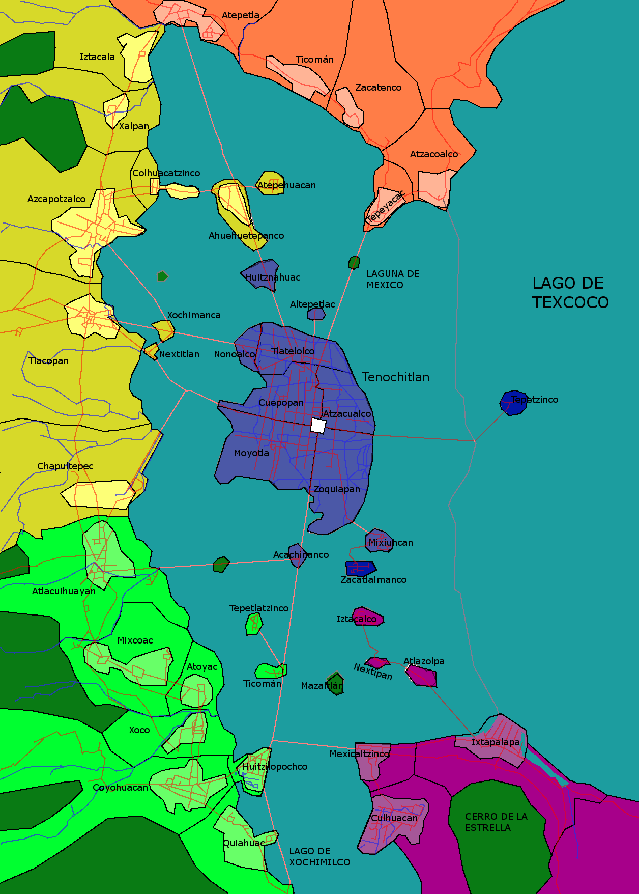
 4maram — Risk Map - Tenochitlan
by-nc-sa
4maram — Risk Map - Tenochitlan
by-nc-sa
Published: 2020-04-10 09:59:35 +0000 UTC; Views: 516; Favourites: 5; Downloads: 0
Redirect to original
Description
I looked for the old layout of the Texcoco Lake and its roads. Then I used Google Earth to identify the old layout of the city of Tenochtitlan and the names of the villages around the lake. The analysis of Google Earth and Google Maps took around 6 hours of continous work.
Then I overlayed the layouts of Tenochtitlan, the surrounding main villages, the lake's border and the positions of the roads and then I painted all on a new layer. That took around 3 to 4 hours.
Size: 1250 wide x 2000 high. Risk colored.