HOME | DD
 ComplexVariable — Aurhim Map (v. 2.1)
by-nc-nd
ComplexVariable — Aurhim Map (v. 2.1)
by-nc-nd
Published: 2014-04-06 03:33:24 +0000 UTC; Views: 835; Favourites: 3; Downloads: 0
Redirect to original
Description
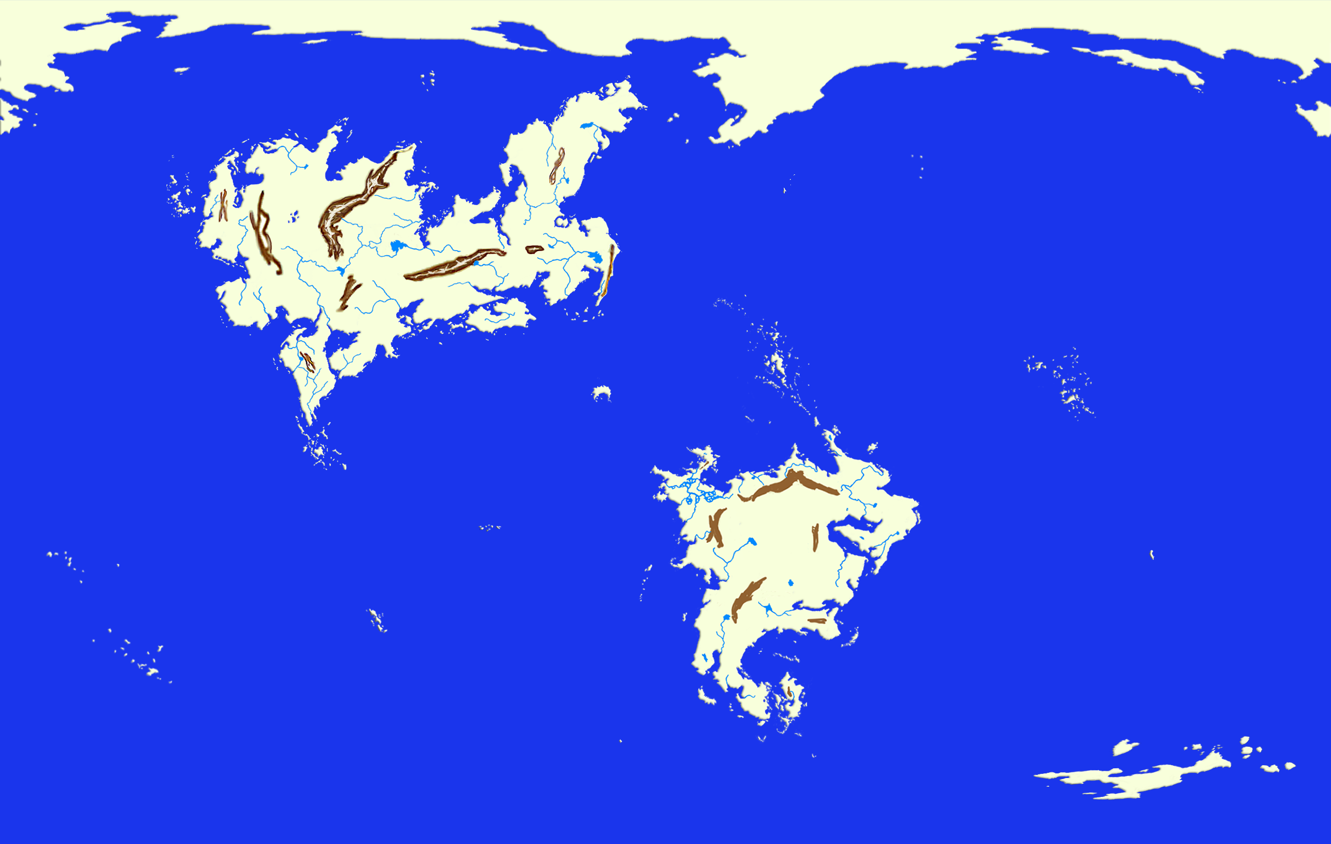
And the map continues to progress! I've made the tectonic plates, started working on the various political maps throughout history, and so on, but those features will be displayed on later maps, independent of this one. This map uses a Mercator Projection, up to ±85° latitude away from the equator.The northern continent is Faern (Pronounced "Fairn"); the southern continent is Seterras (Pronounced "Suh-tare-us"). The small crescent-shaped island smack-dab in the middle of the image is called the Isle of Veir (Pronounced "Vair" (like "Fair", but with a "V" instead of an "F"))
The blobbish thing running across the top of the map is the still-unamed arctic continent (a.k.a "Jeffery"). The reason why it looks so large is because the Mercator Projection makes the vertical distortion increase exponentially as one approaches ±90° latitude. This fact is also responsible for the distorted appearance of the smaller blobbish thing in the lower-right-hand corner, the as-of-yet unnamed antarctic continent (and, until it is named, I shall henceforth refer to it as "Pauline")
The initial setting of the first novel in the "Dahrian Chronicles" series occurs in the center of Faern, to the left of Lake Tarra ("Tar-ah"), where four rivers (the four branches of the Vorraine ("Vore-rain")) intersect in an H-ish (or X-ish) shape.
The brown ugly things are mountains; the dark blue is saltwater; the light blue is freshwater (or estuarial water)).


