HOME | DD
 Daeres — The Realm of Entara (Commission)
#entara #imaginarymap #cartography #commission #commissioned #fantasylandscape #fantasymap #maps #imaginarylandscape #mapmaking #mapsandflags #19thcenturystyle #maps_and_flags #cartographymap
Published: 2021-12-03 15:02:57 +0000 UTC; Views: 3117; Favourites: 26; Downloads: 0
Redirect to original
Description
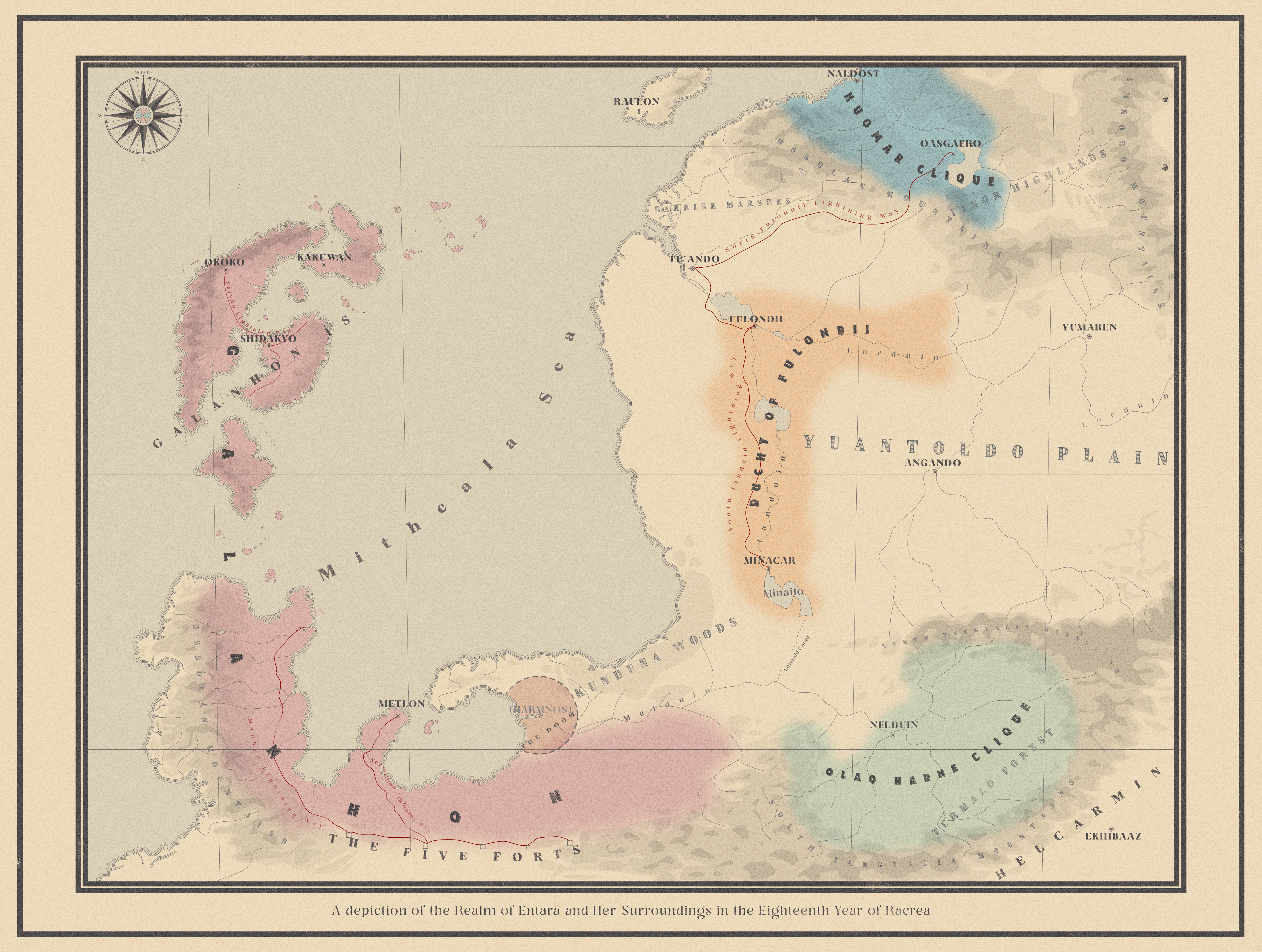
Thank you to Lubyak who commissioned this map from me! You can find them on reddit here www.reddit.com/user/Lubyak/This is a map of a specific region (Entara) in their wider setting. It's very much inspired by the Warlord Era of China's history, which is why at the time the map takes places so many areas aren't marked as part of a state at all. This is also in the southern hemisphere of the planet it takes place on, so that the northern areas are somewhere between Mediterranean/subtropical in climate, and the southernmost parts start to get a bit chilly. That's also why the graticules bend at the top rather than at the bottom, for anyone who's used to maps of/based on western Europe or north America and such.


