HOME | DD
 FloZone94 — Map of Oksandanderi - Native scripts
#neography #oksandanderi #conlang #fantasy #fantasymap #worldbuilding
Published: 2021-08-17 15:09:47 +0000 UTC; Views: 1381; Favourites: 6; Downloads: 1
Redirect to original
Description
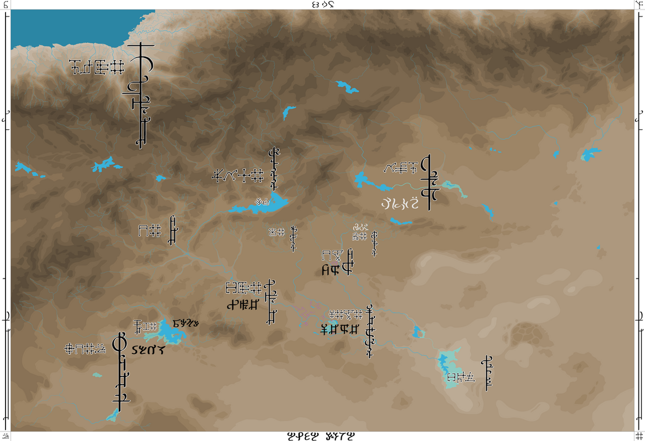
This map shows the fictional land of Oksandanderi with place names given in the native scripts of the region. Writing was invented during the 1st millennium BGS within the Lowlands and along the Yarla river. It became a proper writing system during the so called Formative-Literary period during which the ideographic script, used mainly for taxes and trade, became a logographic system. During the 1st and 2nd century AGS writing spread through Oksandanderi and many new daughter systems formed. The script which developed in the 1st and 2nd century is called Kakhemke "clear script" and it was used to write the Yarlish languages of the Lowlands, mainly Kathurn "clear speech".
There are several variants to it. The archaic system is written horizontally from left to right. During the following centuries two cursive variants developed, horizontal and vertical cursive. Vertical cursive was developed in the Highlands by the Makhat people.
The script was also adopted by other peoples, such as the Ardan people in the south west and the Walkenians in the north east. The rim of the map also shows the name of the entire region in the different languages and scripts. Oksandanderi "Place of apple tree orchards" in the Yarlish languages written in the signs OKSE-MAP-TAN-KANDA in each of the four corners and vertically on the sides. Ban Toh "Great Land" in Walkenian on the top and Alpa Yumta "Blessed Garden" at the bottom in Ardanic.
The overall system of each script is also slightly different. Archaic, horizontal cursive and vertical cursive are somewhere between syllabic and logographic. Walkenian is purely syllabic, with only a few logographs. Ardanic is fully phonographic, somewhere between a proper alphabet and an abjad.