HOME | DD
 JasonCartography — Republic of Namibia
by-nc-sa

#africa #afrika #afrikaans #botswana #desert #german #kalahari #karte #map #mapper #mapping #namibia #southafrica #swakopmund #windhoek #herero #skarpjonas #skarpjonasworks
Published: 2020-04-05 14:43:32 +0000 UTC; Views: 7956; Favourites: 80; Downloads: 0
Redirect to original
Description
GENERAL NOTE
My maps are all public, but if you want to use them further, please mention my DeviantArt page and the original source.
My maps are concerned with both alternative and real scenarios and events.
As far as the completeness and perfect correctness of my maps is concerned, I do not assume any responsibility. In case of minor errors please inform me by a comment.
My Reddit: www.reddit.com/user/SkarpJonas
My Pinterest: www.pinterest.de/skarpjonaswor…
TEXT
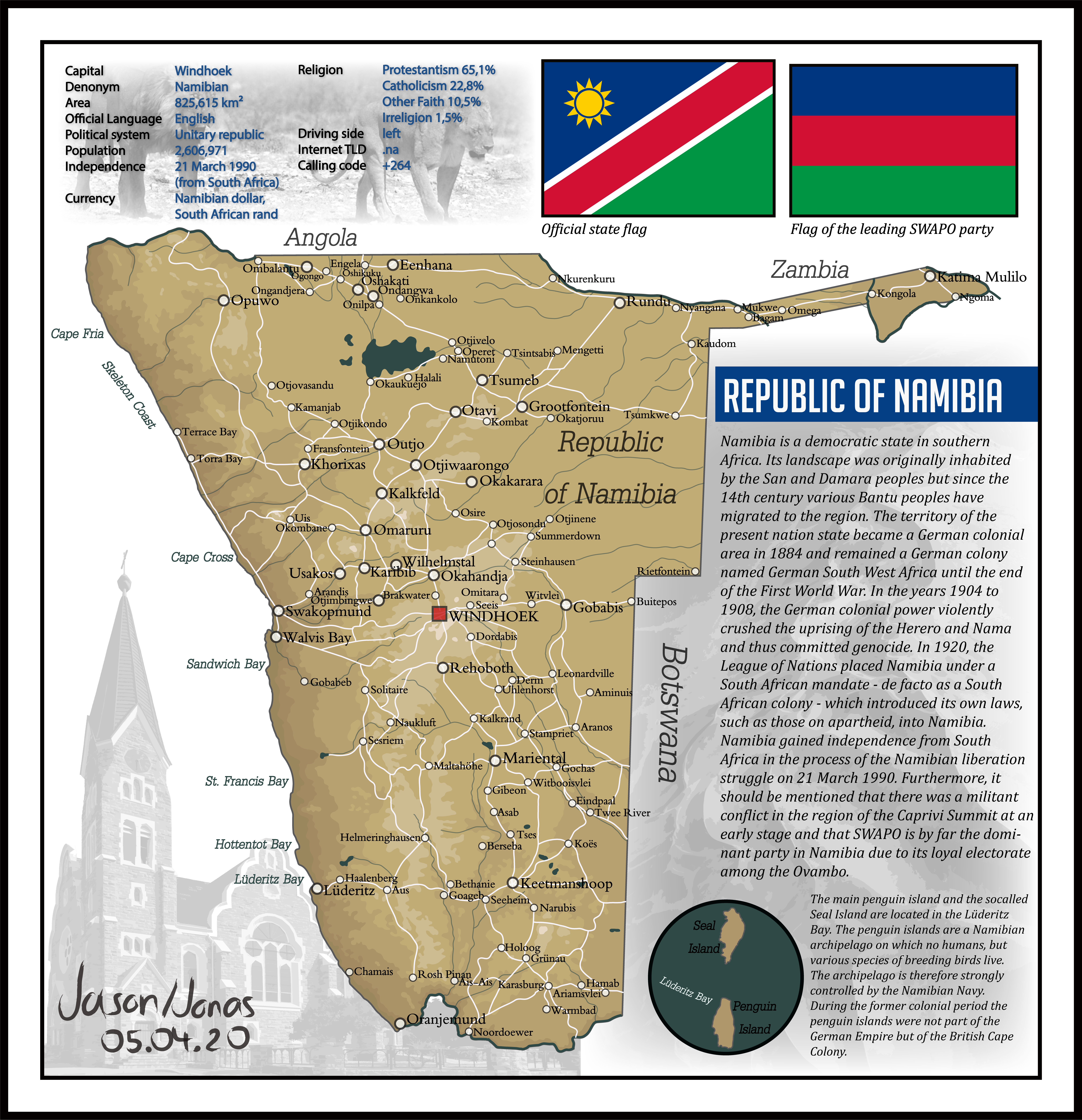
Namibia is a democratic state in southern
Africa. Its landscape was originally inhabited
by the San and Damara peoples but since the
14th century various Bantu peoples have
migrated to the region. The territory of the
present nation state became a German colonial
area in 1884 and remained a German colony
named German South West Africa until the end
of the First World War. In the years 1904 to
1908, the German colonial power violently
crushed the uprising of the Herero and Nama
and thus committed genocide. In 1920, the
League of Nations placed Namibia under a
South African mandate - de facto as a South
African colony - which introduced its own laws,
such as those on apartheid, into Namibia.
Namibia gained independence from South
Africa in the process of the Namibian liberation
struggle on 21 March 1990. Furthermore, it
should be mentioned that there was a militant
conflict in the region of the Caprivi Summit at an
early stage and that SWAPO is by far the domi-
nant party in Namibia due to its loyal electorate
among the Ovambo.
USED FONTS
DilleniaUPC Italic (Place names), Myriad Pro (statistics), Cambria Italic (Information text)
BigNoodleTitling (section names)
SOURCES
sta.sh/01f5eckg22pi (Base map), sta.sh/2atci8mqibm?edit=1 (Background photos)


