HOME | DD
 matsudesign — Tiperyn Political Map (Anterra)
#alternatereality #alternateworld #cartography #country #fiction #geographic #geography #map #mapmaker #nation #nationstates #ns #roleplaying #state #worldbuilding #politicalmap #worldmaking
Published: 2017-12-16 22:43:58 +0000 UTC; Views: 5234; Favourites: 46; Downloads: 0
Redirect to original
Description
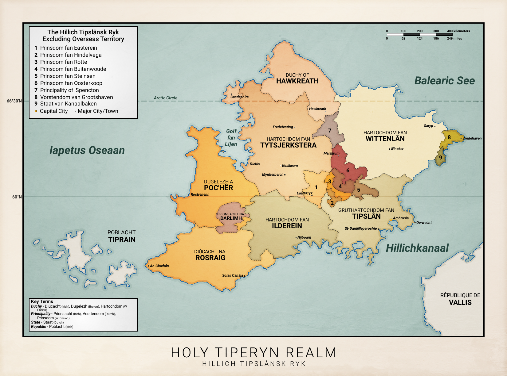
The Holy Tiperyn Realm (West Frisian: Hillich Tipslânsk Ryk; Latin: Sanctum Regnum Tiperia) is a federal ecclesiastical absolute monarchy situated off the western coast of Artemia in Anterra. A federal monarchy with limited devolution of powers to lower nobility, Tiperyn consists of seven duchies and nine principalities each ruled by a separate royal family.These vary, from the West Frisian-speaking duchies of central and southern Tiperyn, to the Irish Gaelic and Breton divisions in the west and the Dutch principalities in the east. Tiperyn's northern most duchy of Hawkreath is considered to by the birthplace of the English language in Anterra, having spread to continental Artemia after the split from Ingvaeonic languages in the 7th century. Meanwhile, the Tiprain island chain to the west - a territory that was conceded as a free Celt democracy after the end of the Great War - is considered the birthplace of the Celtic languages in the region.