HOME | DD
 MrJmZack — Era of the Hero of Time

Published: 2012-06-14 14:07:18 +0000 UTC; Views: 4585; Favourites: 37; Downloads: 140
Redirect to original
Description
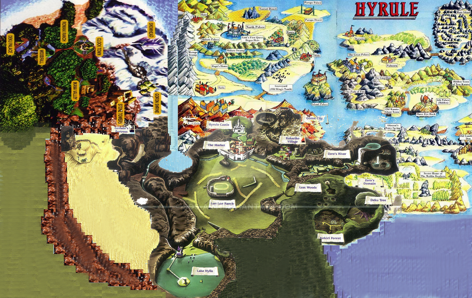
I've compiled a very accurate map of the land of Hyrule as seen during the era of the Hero of Time, from the Legend of Zelda: Ocarina of Time.Note that Zora's river and all of its components lay north of Hyrule: it fits here quite well, and if this is true it would explain my Zora's domain lies north of Hyrule in the retcon we know of as the Legend of Zelda: Twilight Princess. Both are river sources, home of the proud aquatic Zora tribe, and they both lead off to an icy realm on their left-hand sides.
Death Mountain and Kakariko Village are now properly stationed away from Hyrule Castle & Market, as placing them where I had originally had them would have the lower slopes of the mountain right on top of the town! Even in-game, it is clearly further distanced from the town of Hyrule.
Overall, the eastern half of Hyrule was riddles with inconsistencies: if you place Zora's River due east, with Kakariko & Death Mountain just northeast of Hyrule Field, they overlap; when you add the Sacred Forest Meadow into the mix, it reveals a whopper: Forest Temple is sitting on top of Kakariko Village: clearly that cannot be possible.
This layout I have arranged best suits the lay of the land with as few inconsistencies as possible. Enjoy!
Related content


Comments: 1

Just reorient Faron so it doesn't run into Kakariko.
👍: 0 ⏩: 0