HOME | DD
 psyekl — The isle of Cellend- Layout Sketch
by-nd
psyekl — The isle of Cellend- Layout Sketch
by-nd

Published: 2010-05-29 19:42:41 +0000 UTC; Views: 463; Favourites: 2; Downloads: 12
Redirect to original
Description
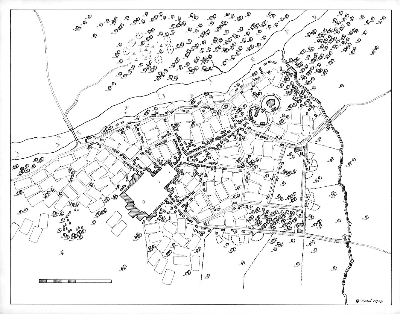
A developmental sketch of a region for my personal fantasy setting. If I'm going to map a region, I need to have names for the features (... and Ley Lines, dragon lairs, Dwarven mines, megalith locations, towns, roads, ruins, shipping lanes, weather patterns, ocean currents, tide schedules, seasonal variations, unique monsters, racial demographics, diplomatic relations, trade routes, watersheds, erosion patterns, migration patterns, ...) o.OPen, ink, pencil, colored pencil, calligraphy
Please consider offering your support to keep work such as this and my other projects readily available by visiting www.patreon.com/ierdesign , see what other files I am offering for free download as well and be sure to visit me on www.facebook.com/ierdesign for updates and to meet our growing family of friends!
Related content


Comments: 1

Many of my drawings go through several stages before being finalized. In this case I drew a map of a region I want to detail and used it as a sketch in order to locate terrain features, borders, place names, the scale, ley lines, megaliths & monoliths and to test the various symbols for marking population centers. While some of the notes made here have not survived to be included in the latest versions of this region, I still refer to this sketch often for reference and inspiration.
👍: 0 ⏩: 0