HOME | DD
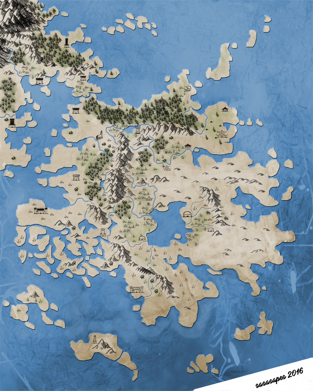
 sasasapes — Satellite image

#cartographer #cartography #mapmaking
Published: 2016-10-23 17:09:40 +0000 UTC; Views: 136; Favourites: 1; Downloads: 0
Redirect to original
Description
Photoshop CS6 Geographic Imager Terrain Shader example.Raw image taken by Shuttle Radar Topography Mission (SRTM) 1 Arc-Second Global.
Downloaded from www.usgs.gov
Conakry 1905 Coordinate System
The place is in Guinea, Africa.