HOME | DD
 Sharrukin-of-Akkad — Tremara Regional Map (May 2020)
#greatlands #curseofsteel #conlang #fantasy #map
Published: 2020-05-31 21:45:30 +0000 UTC; Views: 5029; Favourites: 49; Downloads: 14
Redirect to original
Description
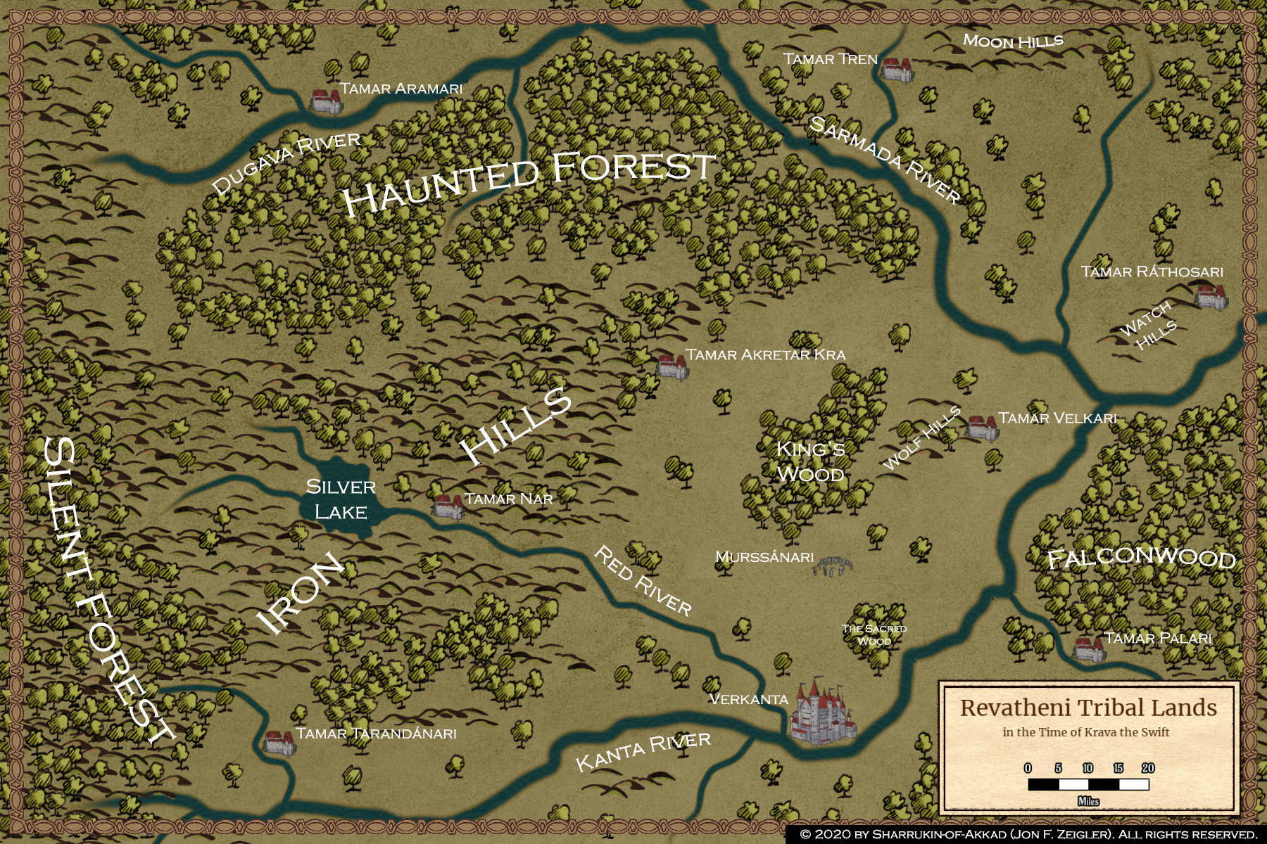
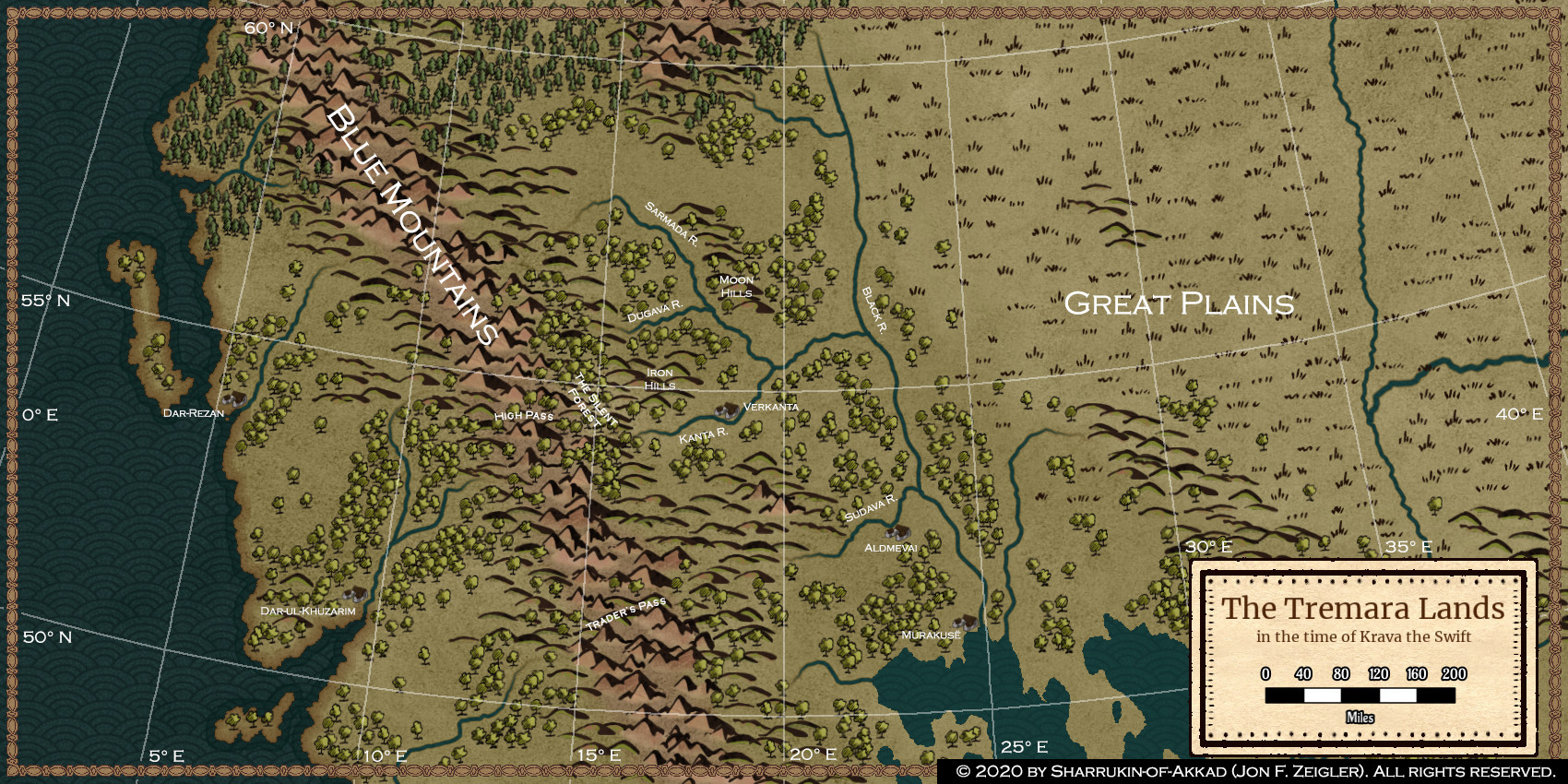
Having finished the "historical atlas" series for the Great Lands, now I'm starting to focus in on maps that will help me keep track of the environment my characters will be moving around in. This is a regional map of the Tremara lands - the territory inhabited by my protagonist's home culture - and the surrounding region.The Tremara inhabit the region between the Blue Mountains in the west, the Black River valley in the east, the great pine forests of the Northmen, and the Lake Country to the south. It's an area of roughly 200,000 square miles, supporting a total population of about 2.4 million. The Tremara are at an early Iron Age level of development - mostly peasant villages, ruled by a warrior aristocracy who fight from chariots with bow and spear. They have some contact with Korsanari and Sea Kingdom merchants who bring in luxury goods and new ideas - these mostly come up the rivers from the Lake Country, or across the Blue Mountains at the Trader's Pass. Most of the outside world considers the Tremara to be barbarians, but they're sophisticated barbarians, with superb visual arts and poetry.
This map is a reasonably finished project, although I expect I'll continue to tweak it in the future as I develop more details of the setting. Next project will be to focus in on a small area of this map, producing a local map that should cover all the territory that plays a part in the first novel in the series (The Curse of Steel). Once that's done, I'm probably going to have everything I need to sit down and produce a second draft of the novel.
Technical Notes: My continent-wide map was put in an orthographic projection and narrowed down to this region using GProjector (Windows version 2.1.8). An image from there was imported as a tracing overlay, and the basic map here was produced, using Wonderdraft (version 1.1) with standard symbol libraries. The final Wonderdraft product was imported into Adobe Photoshop CC, where I added the latitude-longitude grid and all the place names. I have another overlay (not visible here) with national and tribal names.
Obligatory Self-Promotion: If you're interested in my creative process or any of my other work, feel free to subscribe to my Wordpress writing blog , or sign up as a patron on my Patreon page . The latter will get you some monthly exclusives, including big chunks of world-building material or serialized drafts of my novels.
© 2020 by Sharrukin-of-Akkad (Jon F. Zeigler). All rights reserved. You may not copy, alter, or repost this work without my express written permission, nor may you in any other way treat this work as your own.