HOME | DD
 VGCartography — Dark Souls | Map Layout References
#darksouls
Published: 2022-01-18 03:28:41 +0000 UTC; Views: 5087; Favourites: 3; Downloads: 29
Redirect to original
Description
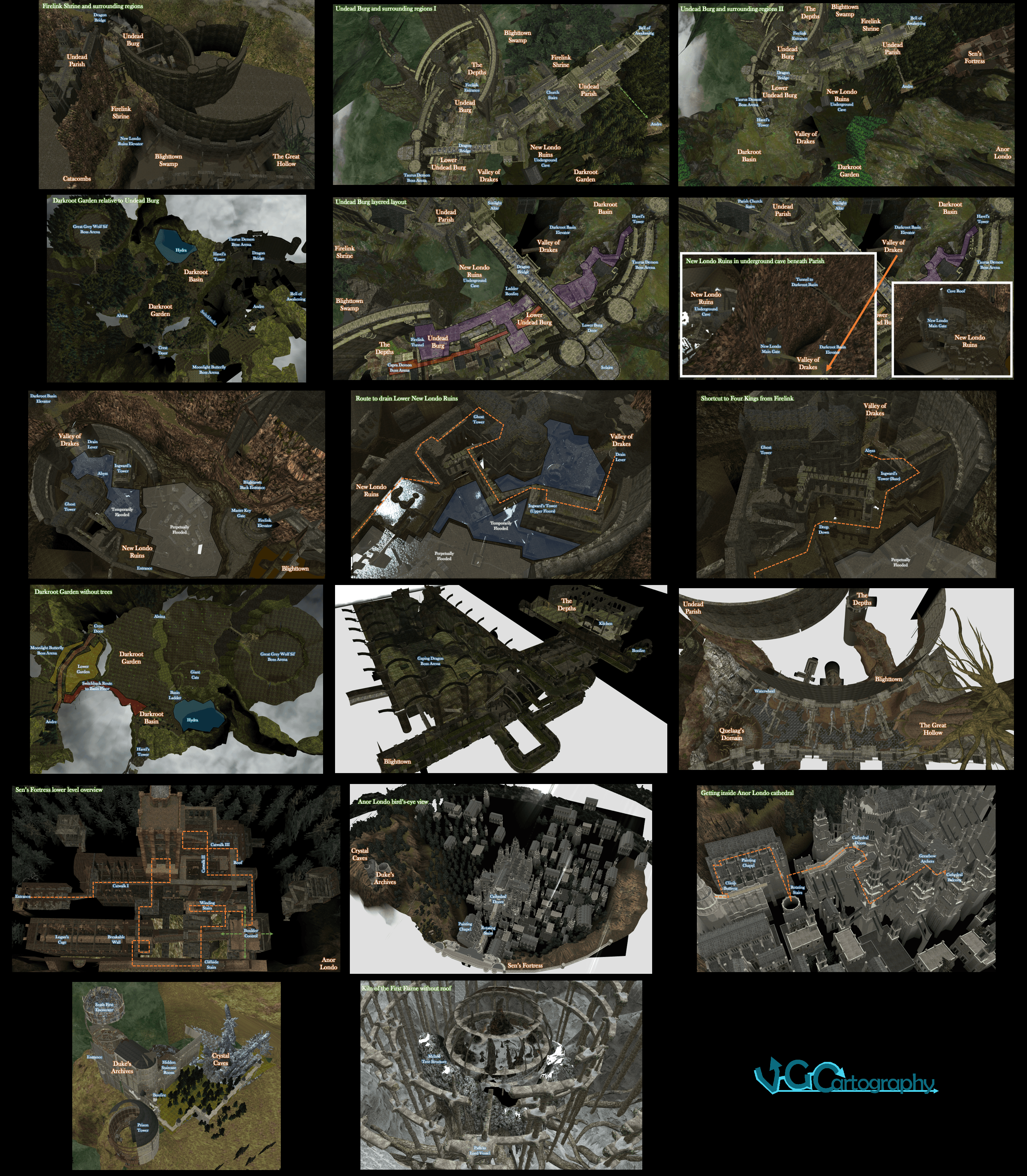
I originally created these before I made the VGCartography moniker, so here is a collection of all of them I shared a few years ago.ORIGINAL NOTES
1 Firelink is in the middle of everything, with Quelaag's Domain almost directly below and the Undead Parish directly above. The curved walls of the Burg are visible from almost everywhere.
2 The Depths seem to get the drainage from the Burg and flush water on through to the swamp.
3 The Darkroot areas are below the Burg in the forested areas at the foot of the walls.
4 The Lower Burg folds back underneath the upper Burg - Capra's arena is almost directly below where you first emerge from the Firelink tunnel.
5 New Londo Ruins are in an underground cave underneath the Parish, strangely enough. The Valley splits the areas of the Burg and the Parish beneath the dragon's bridge.
6 New Londo's basic layout.
7 The route to drain the dark blue areas.
8 Accessible areas of New Londo after drainage.
9 The Garden is hugely expansive but sparse without trees. The large height differences don't come across well here. The orange path is the upper path from Andre to the crest door, with the red path leading off to the Basin floor and the yellow areas below leading to the Butterfly and the garden's alternate entrance.
10 Havel's Tower is truly massive, rooted in the Basin but leading all the way up to the Taurus Demon.
11 The Depths are dense but you ultimately exit to Blighttown in the same direction as the entrance from the Lower Burg.
13 The collapsed door to Anor Londo's old gateway is off the bottom of this image.
17 The roots below and the melted tree husk imply the Kiln sitting in another large tree similar to the Great Hollow.