HOME | DD
 altmaps — Yet another map of the Greater Netherlands
#cartography #geography #map #netherlands #althistory #alternatehistory
Published: 2018-09-26 19:55:47 +0000 UTC; Views: 4553; Favourites: 49; Downloads: 55
Redirect to original
Description
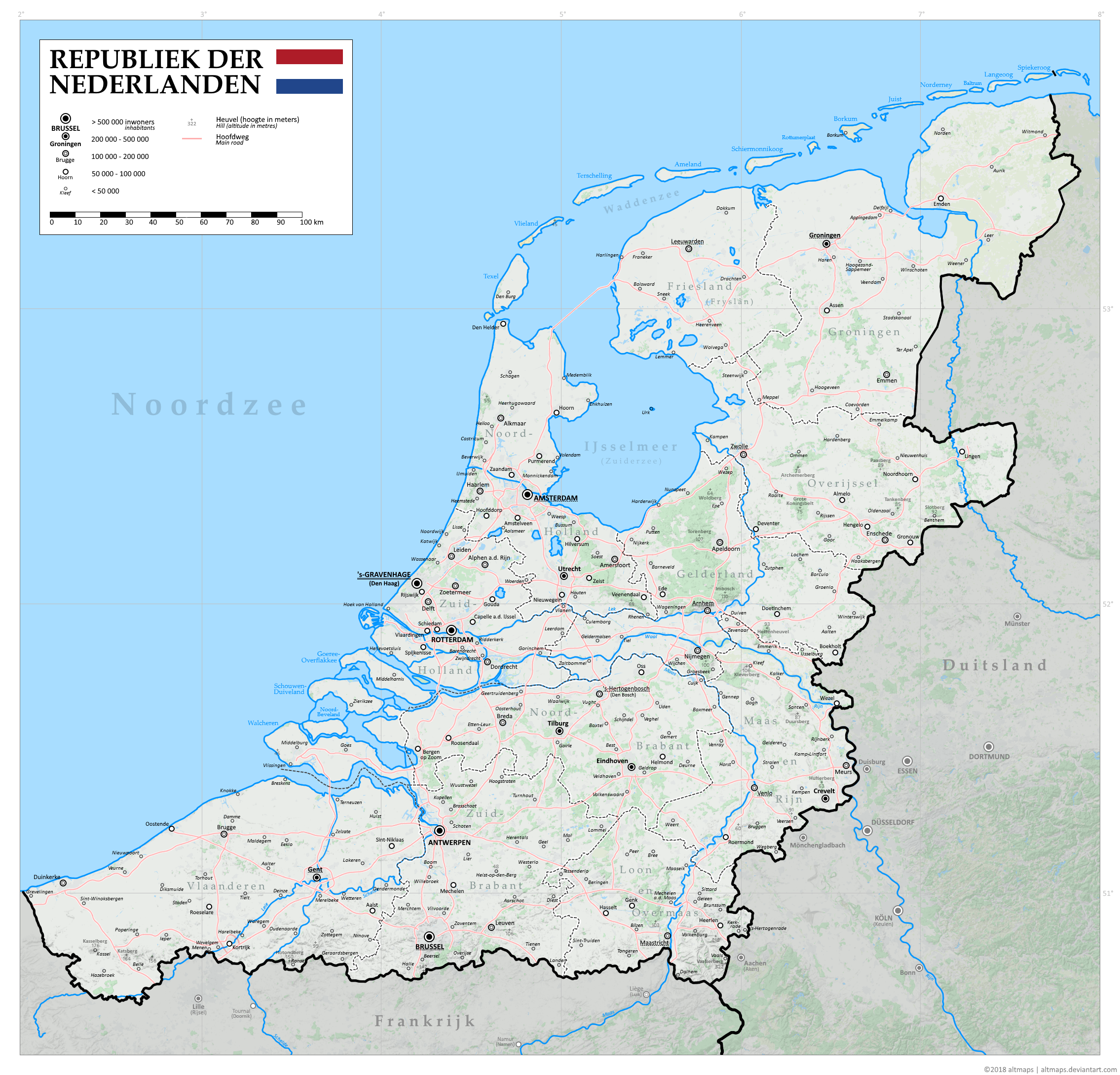
I know, I know, I should probably make some new stuff. (Or get back to my ongoing, unfinished projects). But recently I found out about gokml.net/maps , which allows me integrate Google Maps layers into my map projects. So I went ahead and tried it out. It also includes the many small improvements I added to my previous Greater Netherlands map .I'm also (slowly) working on a write-up detailing the alt-history behind my Greater Netherlands (long overdue). Stay tuned for that.
Related content


Comments: 4

Heh, well. More detail is always good. Creates a very immersive scenario. I like your different graphical takes on the situation. Plus, it gives me the opportunity to ask how those borders formed! Some of them are odd as I've always noticed on the other maps.
What I mean is, the modified border to Germany at the Rhine follows neither the borders of the old HRE statelets, nor dialect borders. In the Emsland, the Netherlands gained East Frisia, Bentheim (both heavily influenced IOTL) and the Upper County of Lingen (a Nassau-Orange possession before the old House of Nassau-Orange died out). So that makes sense. Though, Still kinda trips me that the rest of the Emsland remains German. The Netherlands might as well have taken that as well :V
But the borders of Maas and Rhine? Vaguely the Duchies of Cleves and Guelders and the (once again, Nassau-Orange) Principality of Moers, I guess, but also... not really... The weird bumps around Wesel, for example, cutting right through Cleves, while OTOH extending southwards a bit more than the historical borders...
👍: 0 ⏩: 1

There's no Emsland because there's no plausible Dutch claim on it. On the other hand, there are alt-historical reasons why the other territories did become Dutch, and why the Meuse/Rhine borders are what they are. It'll all be in the timeline which I'll post when the write-up is done.
 (Smile)")
👍: 0 ⏩: 0

Waarom wel de Afsluitdijk en Wieringermeer maar geen Flevoland?
👍: 0 ⏩: 1
1) Geen Flevoland vanwege lagere bevolkingsdruk.
2) Er zal nog steeds noodzaak bestaan voor kustbescherming tegen watersnoden, dus het lijkt plausibel dat er zoiets als een Afsluitdijk en Wieringermeerpolder zouden kunnen bestaan in deze tijdlijn. (Weliswaar was landaanwinning ook een motief voor de laatste, maar bovenal verkortte het de Noord-Hollandse kustlijn.)
👍: 0 ⏩: 0