HOME | DD
 atlas-v7x — America Elevation Map

#america #elevation #map
Published: 2018-02-06 11:04:10 +0000 UTC; Views: 4352; Favourites: 46; Downloads: 182
Redirect to original
Description
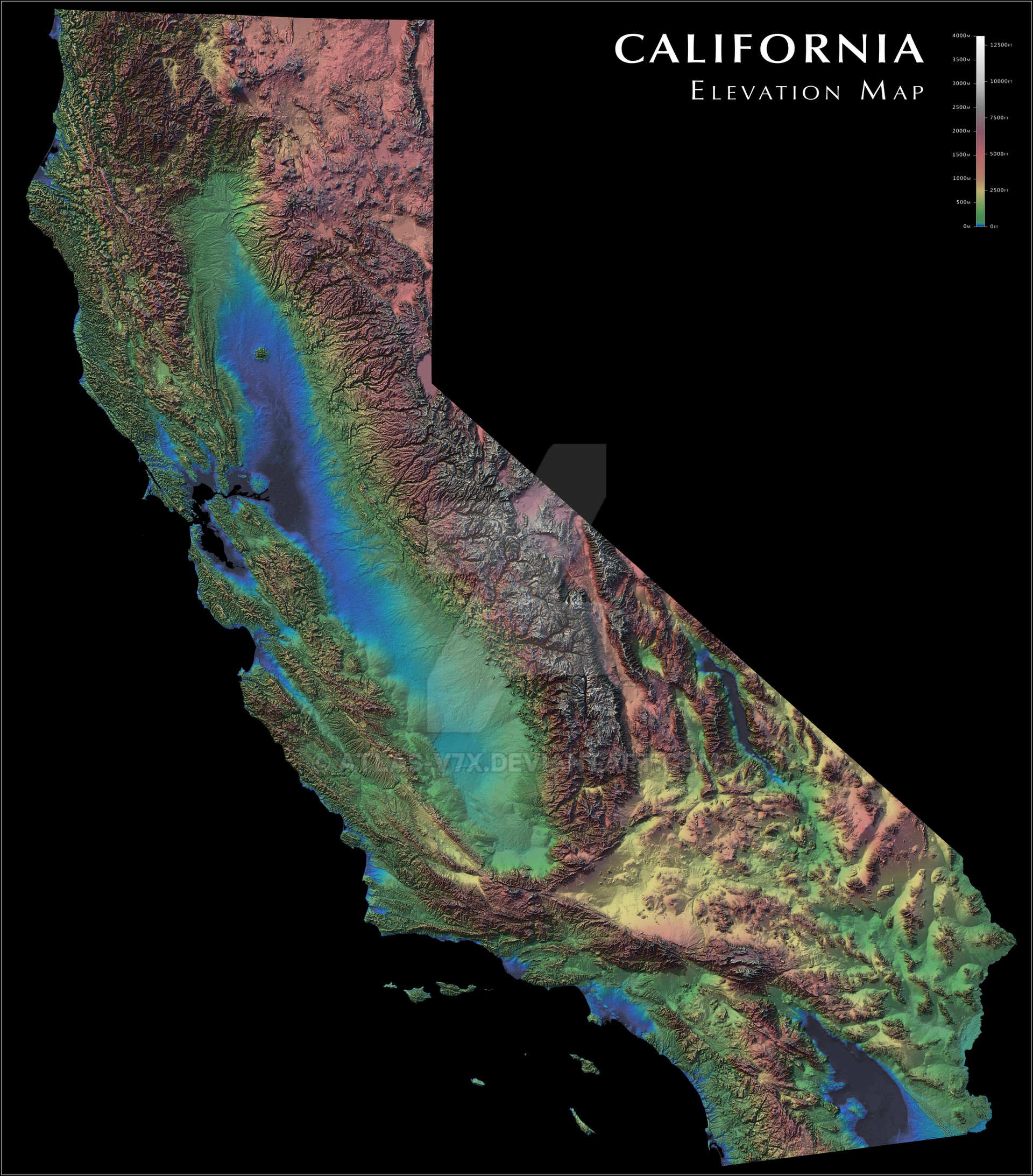
Shaded elevation map of the contiguous United States of America.Alternate and higher resolution versions available.
Related content


Comments: 10

Very nice map. Are the blue areas submerged then, if so how much?
👍: 0 ⏩: 1

Green begins at 100m, so blue to green is between sea level and 100m.
👍: 0 ⏩: 0

That's USA, not whole America, but still very nice.
👍: 0 ⏩: 1
It's not the whole USA either. Thanks!
👍: 0 ⏩: 0


I always found the Snake River basin to be a very conspicuous hole in the Rocky Mountains.
👍: 0 ⏩: 0
