HOME | DD
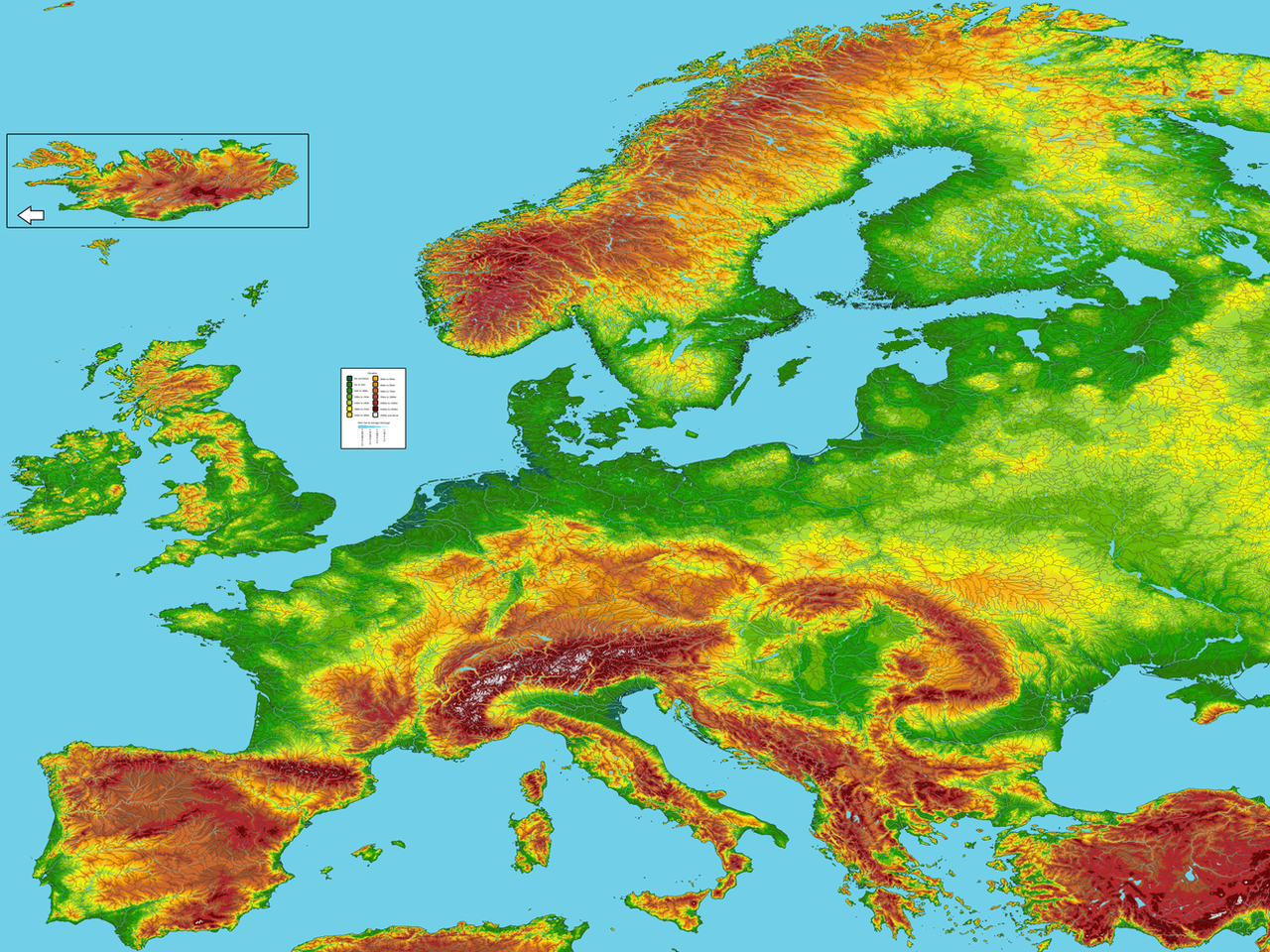
 dmayben505 — Blank Pixelated Geographic Map of Europe

#europe #geographic #map #pixel #pixelated #topography #althistory #blankmap #blank_map #cartography #geography #mapmaking #althistorymap #cartographymap
Published: 2023-08-13 06:58:06 +0000 UTC; Views: 1872; Favourites: 6; Downloads: 14
Redirect to original
Description
A follow up to my previous map (www.deviantart.com/dmayben505/… )
This map is double the scale (about 1:50000 at 53 degrees latitude N) of the previous entry, giving it much better rendering on coasts. Additionally, this one is pixelated, which will hopefully lend itself well to edits in simple image editing software like paint.net. I also made some minor improvements such as manually editing the shoreline to line up better with the coasts generated in QGIS. I added a few extra levels for elevation also to better display the change from highlands to mountains, particularly notable in Spain and southern Germany. The highest elevation (2500m) was chosen as it the snow line (where mountains are snow covered year-round) in the northern Alps, as well as (roughly) the maximum height for year-round human habitation in Europe.
Unfortunately I had to trim the margins (eastern Turkey, much of North Africa, the Caucasus, western Russia) in order to get under DeviantArt's 200megapixel limit. I will likely upload the full size map split into two as I don't like the aesthetics of what I had to trim it down to. I made this map in paint.net and have most of the major features in an original as layers, so please let me know if you'd like me to upload the map with some of the features (such as watershed boundaries) changed or removed. Hopefully someone finds this as useful as I believe it to be- I've looked for a good blank map of Europe for a long time, and given that I never found one with everything I wanted, I decided to make one myself.
**Due to this map's size you will likely need to download it to see it in its full resolution**


