HOME | DD
 dmayben505 — Blank Geographic Map of Europe with Watersheds
#catchment #europe #geographic #geography #map #topography #watershed #althistory #cartography #mapmaking #historymap #blankmap #blank_map
Published: 2023-06-04 05:30:31 +0000 UTC; Views: 1138; Favourites: 4; Downloads: 9
Redirect to original
Description
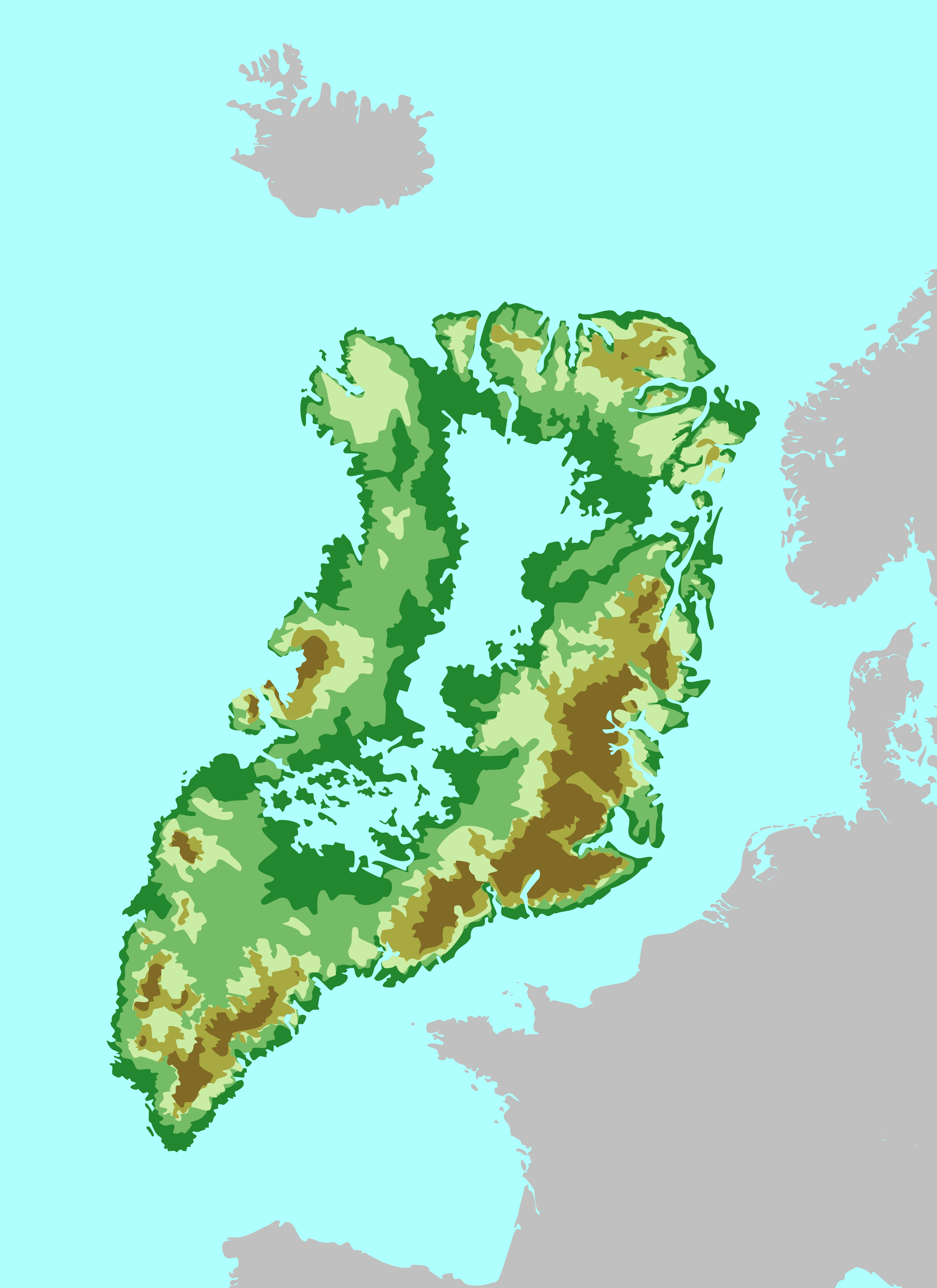
***somewhat work in progress but usable in the meantime***
This is a geographic map of Europe, Asia Minor, and part of North Africa created through QGIS utilizing data from Hydrosheds (www.hydrosheds.org ). I have often found myself searching online for blank maps for projects and always found ones with either too much detail or not enough detail for my purposes. This is a relatively simple map consisting of elevation, water features (up to level 11 in Hydrosheds), rivers (with an average discharge of 100 m3/s or greater), and level 8 watershed boundaries. Anyone is free to use this map if they like, and credit is always appreciated but not required. Please let me know of any feedback for the map as I'm currently tinkering with different features to improve it but wanted to get it submitted in the meantime.
The scale is roughly 1:1000000 when centered on northern Germany (approximately 53 degrees latitude). This map is already quite large but some of the features look a little messy to me and I believe it would actually render better at double the size (roughly 1:500000 scale). Because of how QGIS displays elevation data- or at least the data set I was using- it was difficult to get clear coast lines without sacrificing the accuracy of the heightmap right up to the coast. This is particularly noticeable in sharp increases in elevation near coasts- such as the fjords of Norway- and resulted in some areas that are actually small inlets being colored the same as sea level land. I did my best to manually go through and correct the larger of these, but they're so numerous in places with rough coasts that I'm still seeking a better way to generate them on the next version of this map.
The reason that I included the features that I did is because I greatly enjoy creating alt history maps and noticed that I was making some glaring geographic errors when imagining new borders. I was guilty of using rivers as easy lines on a map to use for borders, when in reality, most rivers- other than the largest ones like the Rhine or Danube in Europe- are often utilized far more as arteries than borders. Humans utilize rivers for travel and shipping and often settle in the catchment areas of rivers, rather than sticking to one side. This is the reason I included the level 8 watershed boundaries. Watersheds are the borders between catchment areas of water features and are often situated on ridge lines and mountain peaks, and are far more natural borders in human settlement than almost anything else. While watershed boundaries can become a bit more arbitrary the closer you are to the coast, I believe that they're a good approximation for where natural borders would lie in many cases, rather than along rivers or arbitrarily drawing a line on a map.
Related content


Comments: 3

👍: 1 ⏩: 1

👍: 1 ⏩: 1
👍: 0 ⏩: 0