HOME | DD
 DrOfDemonology — Star Trek Map 1
#federation
Published: 2014-09-17 23:38:08 +0000 UTC; Views: 25799; Favourites: 140; Downloads: 654
Redirect to original
Description
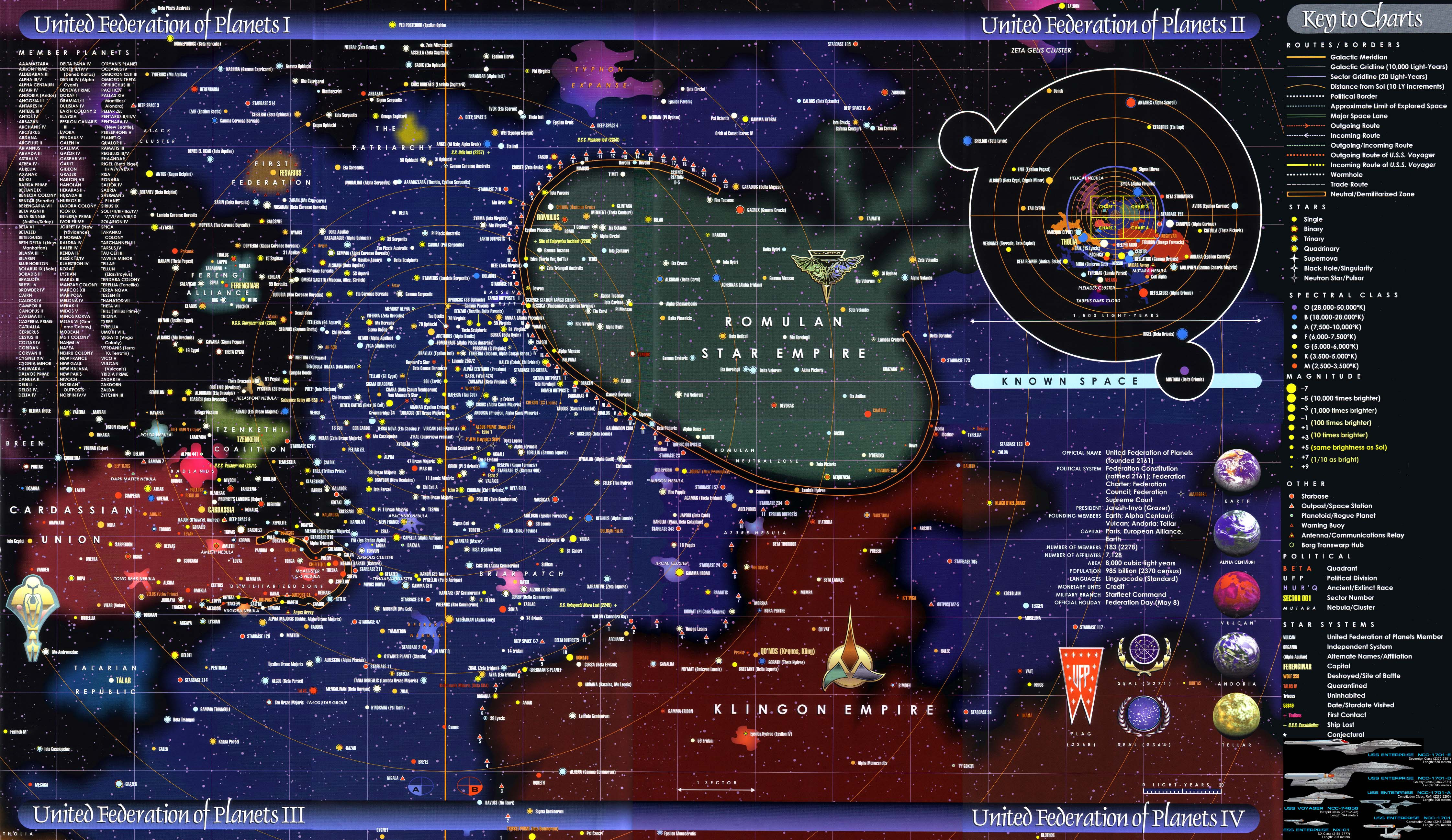
To make this very clear, I did not draw this. I found this after googling for it. The map is from the Star Trek: Star Charts book; and shows the Federation and its neighbours. It's pretty much the most canon map of the Star Trek world that you can find (even if much of it isn't accurate when it comes to distances) and the one I use as my base guide.The only reason I'm posting it in my Scraps section is so that readers of my Star Trek Calypso series have an actual map to reference. Hope it helps.
The map is of course copyright by Paramount, blah blah blah.
Related content


Comments: 6

👍: 0 ⏩: 1

👍: 0 ⏩: 0

👍: 0 ⏩: 0

I see the Sovereign class Enterprise. I am taking this map is as of the mid to late 24th century then?
 (Wink)")
👍: 0 ⏩: 1
As far as I know, yes. It seems to include everything from the mid-22nd to the end of the 24th
 (Smile)")
👍: 0 ⏩: 0