HOME | DD
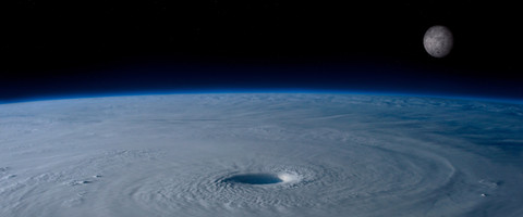
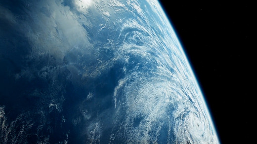
 jswis — Astronauts View Irene

Published: 2011-08-26 14:27:37 +0000 UTC; Views: 610; Favourites: 25; Downloads: 26
Redirect to original
Description
One comment made was that the storm system is as large as ALL of Europe!Astronaut’s View of Hurricane Irene [link]
High above the Earth from aboard the International Space Station, astronaut Ron Garan snapped this image of Hurricane Irene as it passed over the Caribbean on Aug. 22, 2011.
The National Hurricane Center noted on Aug. 22 that Irene is expected to produce total rainfall accumulations of 5 to 10 inches across Puerto Rico, The Virgin Islands, the Dominican Republic, Haiti, the Southeastern Bahamas and the Turks and Caicos Islands. Isolated maximum amounts of rainfall may reach up to 20 inches.
Related content
Comments: 17

This is beautiful. It's a really pretty shot. I get hit badly with Irene, but I loved studying it, just going on my porch while the rainband was hitting my state. I'm amazed with this, though. It's just... so... amazing.
👍: 0 ⏩: 0

Is hurricane Irene hitting near Vancouver in Canada?
👍: 0 ⏩: 1

As far as I know hurricanes very really make it a far north a Canada. They need warm water to fuel them so the "eye" stays near the ocean. Once they get to New England the water starts getting too cold but that does not rule out the outer parts (the north-west edge from going inland to mess things up).
👍: 0 ⏩: 1

So it won't come to Vancouver or anywhere near there?
👍: 0 ⏩: 1

Oh no... this is hitting me tomorrow... Supposedly i'm in the part where its 50 - 85 miles... for the wind.... ugh..... blackouts, wind, rain, mech.... 
👍: 0 ⏩: 0

it brakes my heart to see such a storm Like this , my thought and prayers are with them tonight
👍: 0 ⏩: 0

Oh goodness how big that is! Did any news report said anything when this storm will calm?
👍: 0 ⏩: 1

Early n ext week, when it travels far enough to be over colder water.
👍: 0 ⏩: 1

Well, it seem I will be seeing Ms. Irene tomorrow . Wish me great luck!~
👍: 0 ⏩: 0

I was told Ms.Irene was about 100 miles wide?... That is true? I visiting some my family in New Hampshire , Look like it was not the best of week.
👍: 0 ⏩: 1

One news report stated that it was 1/3 the size of the East coast. I do not know which dimension is the greatest east to west or north to south but it's big. look at [link] it goes from the southern tip of Florida all the way to North Carolina. That's over 100 miles. From the tip of Florida to it's northern border with Georgia is over 300 miles.
👍: 0 ⏩: 0

that is so big...is it going to hit new jersey bad too?
👍: 0 ⏩: 1

It's an inexact science to forecast. If you watch any weather program they always show a widening path for a hurricane because they can only accurately predict around 24 hours. it's influenced by the jet stream, surface temperature etc. Once it make landfall it usually slows and becomes more unpredictable. They have told people in Hoboken, NJ lower Manhattan in NYC to be prepared to evacuate. Long Island also has warning of flood, heavy surf. It usually gets hit the hardest because as a storm usually follows the coast but can be centered east or west of the coast by up to 50 miles. North western New Jersey seldom gets much of the high winds but can get a lot of rain as the winds of the hurricane are counter clock wise.
👍: 0 ⏩: 2

It's not that from from the coast maybe 20-25 miles. Lots of wind and heavy rains probably.
👍: 0 ⏩: 0

what about East Brunswick, New Jersey?
👍: 0 ⏩: 0


