HOME | DD
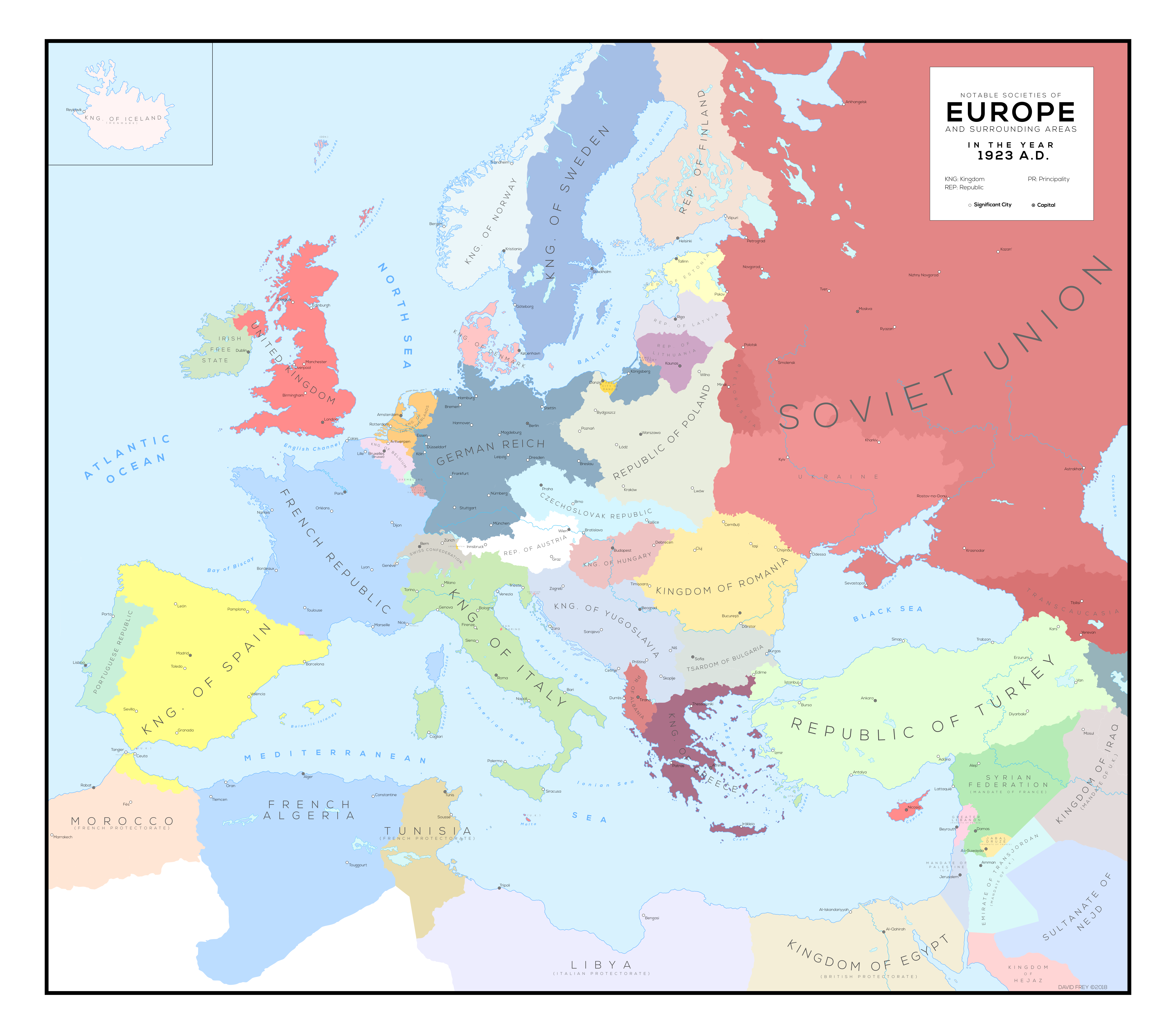
 Robin-Maps — Europe and Surrounding Areas in 1923 A.D.
#cartography #europe #history #map #maps #political #war #world #ww1 #1923 #vector #ww2 #wwii #ww2worldwar2 #robinmaps
Published: 2018-03-03 20:03:27 +0000 UTC; Views: 6287; Favourites: 54; Downloads: 0
Redirect to original
Related content


Comments: 8

Whats that stripe of land between Poland and Lithuania?
👍: 0 ⏩: 1

That's the Memel territory. It was under French administration at the time.
👍: 0 ⏩: 0


I love your Map series  (Smile)")
What have you used as base map for this?
👍: 0 ⏩: 1

Thank you so much! I traced it from another map that I now can't remember the name of, so it's kind of my own now. As in I have a lot of control over changing it in my file.
👍: 0 ⏩: 0
