HOME | DD
 snapshot-anterra — Naseristan Topographical Map by Tiperyn
#arab #cartography #civilwar #fanfic #fantasy #fiction #gaming #kurdish #kurdistan #map #mapmaker #maps #naruto #nations #nationstates #persian #politicalscience #politics #roleplay #scifi #states #worldbuilding #worldmap #mapmaking #globalpolitics #artifexian #kurds
Published: 2018-05-14 15:01:40 +0000 UTC; Views: 2868; Favourites: 43; Downloads: 21
Redirect to original
Description
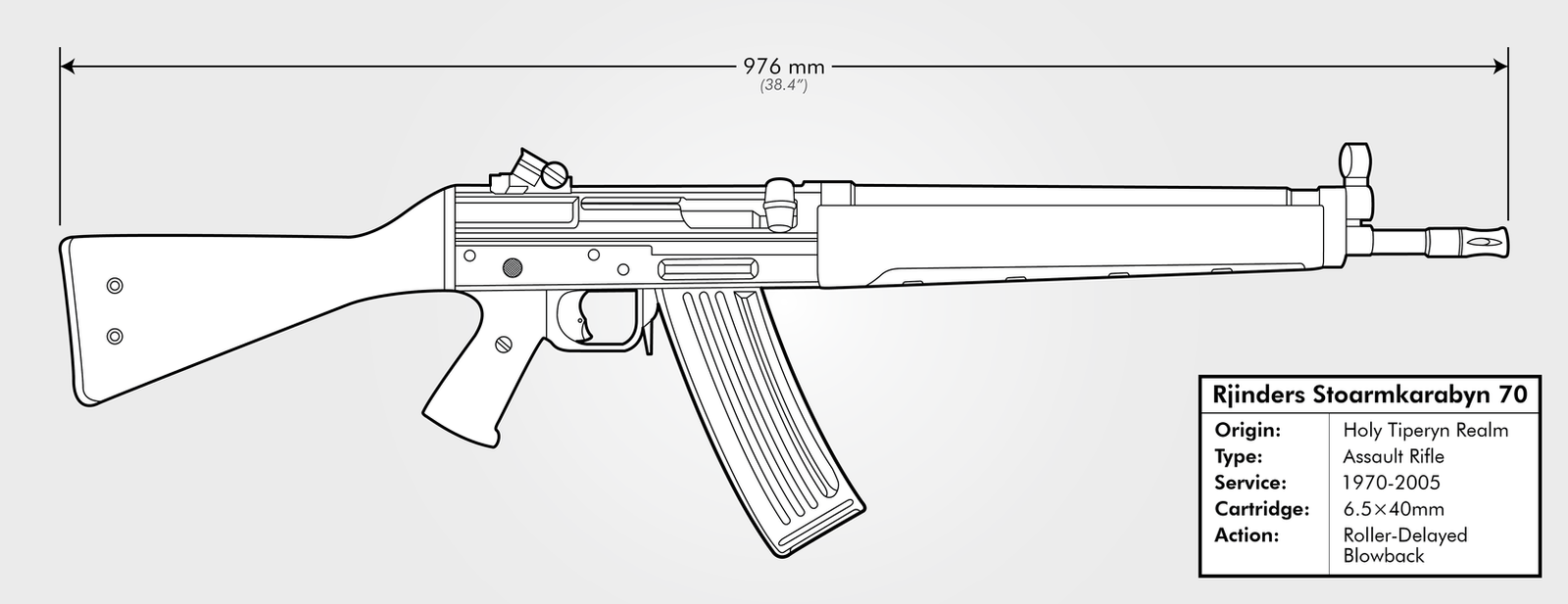
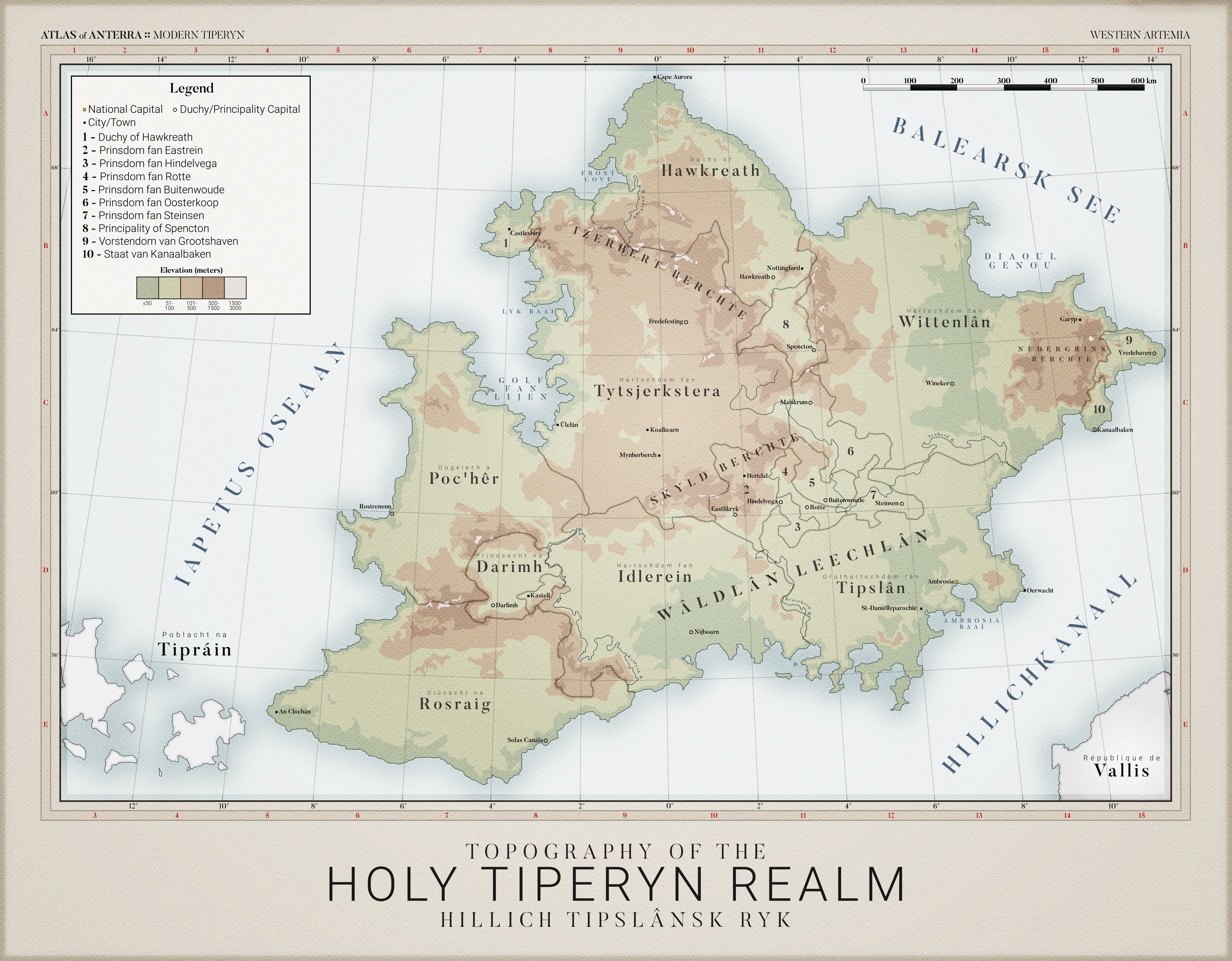
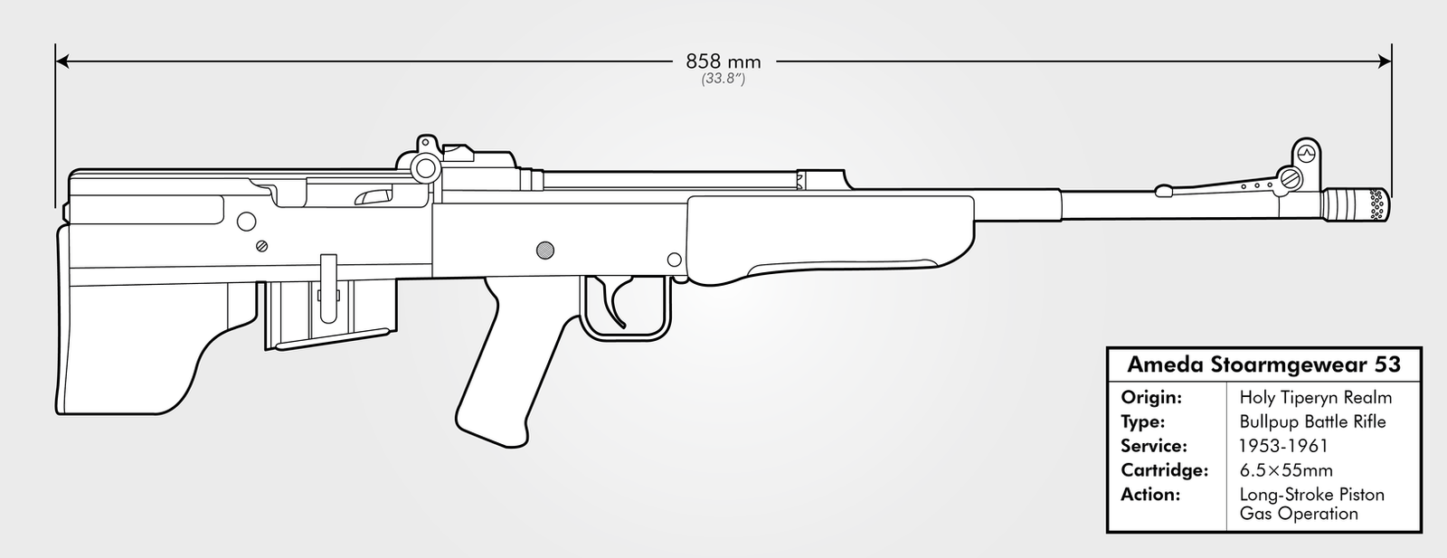
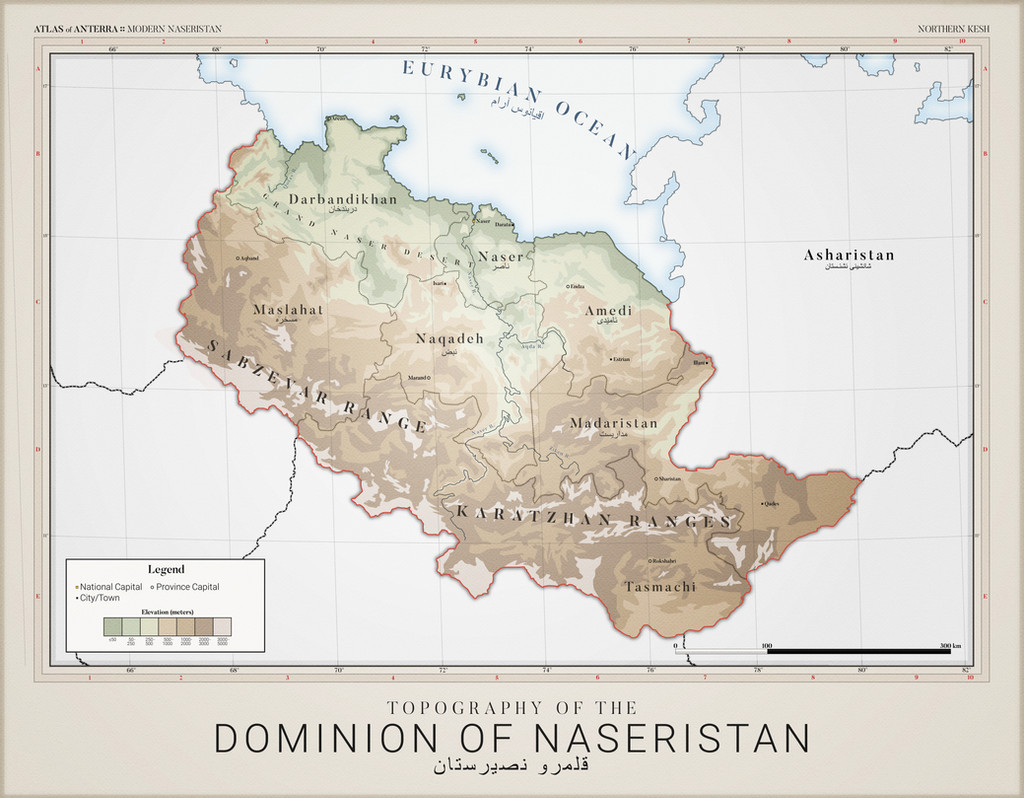
Naseristan (Persian: نصيرستان, Naşīrestān; Arabic: الناصرستان, al-Nāṣirīyah) is located in Northern Kesh to the west of Asharistan. Formerly a part of a grand caliphate prior to the Great War, the territory was split between Tiperyn control in the north and Persian Shia nationalist control in the south. Only after the Kesh War of the 1950s was Naseristan unified as a client state of Tiperyn under the control of the Arab minority of the northern coastal regions. Since its unification, civil war and insurgency has persisted in the country.The northern provinces of Darbandikhan and Naser are largely ethnically Arab and major hubs for trade in the region. Inhabitants of Amedi largely speak Kurdish, while Maslahat, Naqadeh and Madaristan speak primarily Dari, Pashto and Tajiki. Meanwhile, the mountainous and largely isolated province of Tasmachi is home to Naseristan's ethnic Uzbeks.
This was created by community member Tiperyn (BCMatsuyama). Want in on the community that this map was made for? Check out Anterra at our Discord !