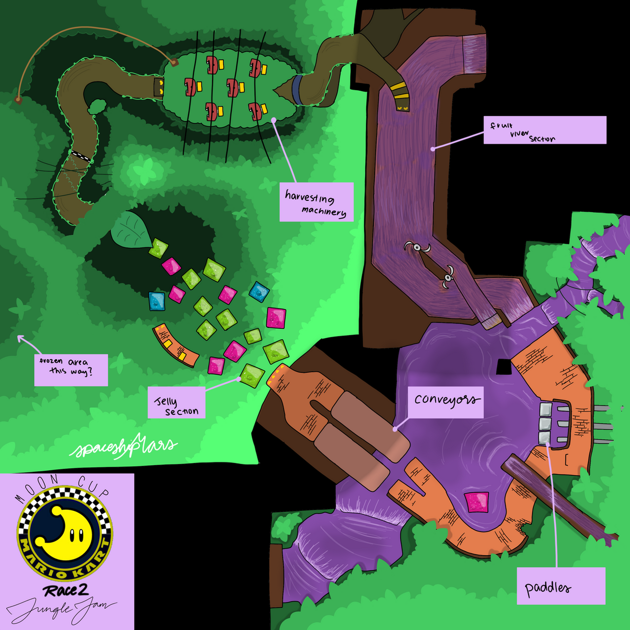
spaceshipmars — Hebra Region Map
#hyrule#rito#snow#zelda Published: 2020-06-25 05:21:30 +0000 UTC; Views: 315; Favourites: 1; Downloads: 0 Redirect to originalDescription
The Hebra Region encompasses some of Hyrule’s most northern reaches. It encompasses ridgelands in the south, plains in the center, hilly taiga forests in the east, and the snowy Hebra Range in the north. This region is the ancestral home to the Rito Tribe, who built the very impressive and very tall Rito Village we know today. As the legend goes, an Ancient Rito archer was trying to keep Hebra’s tallest pine tree from plunging into Lake Totori during a storm and causing a flood. He took his bow and shot three arrows at its roots to keep it in place. Of course, the Rito made this their new home, and built paths up and around the tree, perching in its branches. While the town which stands here now is the same, the tree has rotted over the years, and was magnificently encased with metal and rock to keep the town alive. Although it’s core is metallic, modern Rito Village is thriving and well, and filled with luscious greenery. To the east of the region lies Satori Mountain, where a sleeping god is rumored to bring life to the wildlife on his mountain. The northern Hebra Range hosts a collection of sites, such as the Showshield Lodge, where many of Hyrule’s finest skiers and surfers go to train, and the mysterious Peak Ruins, the once home to a small settlement of people, although not much is known due to its abandonment by its people and due to the erosion and weathering from the harsh snowstorms of the Hebra region. Some say Yetis live in the northern reaches.
Related content
 spaceshipmars — Hebra Region Map