HOME | DD
 ZedKalEios — Creating another region from scratch. (gif)
Published: 2014-05-02 10:29:26 +0000 UTC; Views: 1486; Favourites: 22; Downloads: 9
Redirect to original
Description
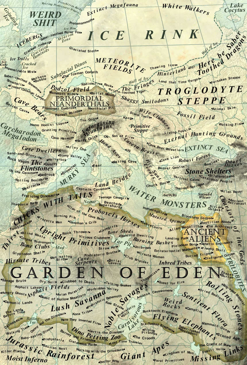
A long time ago I saw a fan-made pokemon continent that was divided into many region maps, often with little pieces of one or two edging over the boundary into another. That was the start of what would become my desire to make my own map, with the selling point being that I wanted to have two regions separated by the map boundary - like Kanto/Johto, only vertical rather than horizontal.You've probably seen what became of the upper segment, the Izaga Region . Now I present the lower segment, the Ashido Region . I don't know if I'll make another map after this until I've completed the Izaga -Ashido 143-entry Fakedexes, but here we are.
Town/city markers and route colors (c) Nintendo
Topography/lay of the land (c) ZedKalEios
Related content


Comments: 8

Looking at the image for Gangirox, I'd say I need a little more to work with. It's a bit muddled, and there isn't exactly a regional outline(borders) from what I can tell. If you could provide a clearer idea of the topography(like making a basic copy in MS Paint even in single line segments) I'd be willing to give it a shot in the above Sinnoh style(4th Gen style).
Keep in mind, however, that my time to sprite really has fallen off over the past several months. It'll be a while before I can get a return to you even if I started working on Gangirox soon.
👍: 0 ⏩: 1

I'll try to make a MS Paint version of it. And the outline looks like AZ.
👍: 0 ⏩: 0


")
Much appreciated, thank you.
👍: 0 ⏩: 1