HOME | DD
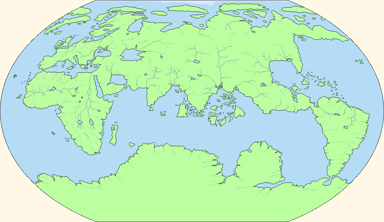
 Ashtagon — Oronce Fine's 1531 map, re-projected

#map #world #k7c #oronce_fine
Published: 2018-03-02 07:39:15 +0000 UTC; Views: 4282; Favourites: 13; Downloads: 14
Redirect to original
Description
Source image: www.loc.gov/item/2005630228/Original map by Oronce Finé (aka Orontius Finaeus) in 1531, re-projected to Kavraiskiy-7 projection. Source map used Corvus Island as its zero meridian. South pole below 80° not converted, because the original map lacks any detail. The conversion process introduced additional distortion due to the technique used and low resolution of reference points. The distortion is especially noticeable around the "Panama" area; this is where the original map was interrupted.
Related content


Comments: 4

👍: 0 ⏩: 0

What program did you use to re-project the map, if I may ask?
 (Smile)")
👍: 0 ⏩: 1

It's a time-consuming manual process. It involves starting with a map that has clear gridlines, then taking each grid square (eg a 30 by 30 degree area, smaller gives better fidelity) , using the trapezium tool (or whatever your art program calls it) to stretch that into a square, repeat this for every such square, assemble all these squares into a single plate caree map projection, then use g.projector to reproject that into the preferred map projection. It's insanely time-consuming to do it well, and I'm not really satisfied with the above result, but I don't have the patience to try a do-over.
👍: 0 ⏩: 0
