HOME | DD
 EndriuMaster — Three rather unknown continents

#continent #continents #map #mapa #three #topography #unknown #kontynent #topograhic
Published: 2015-04-18 22:37:14 +0000 UTC; Views: 4437; Favourites: 59; Downloads: 33
Redirect to original
Description
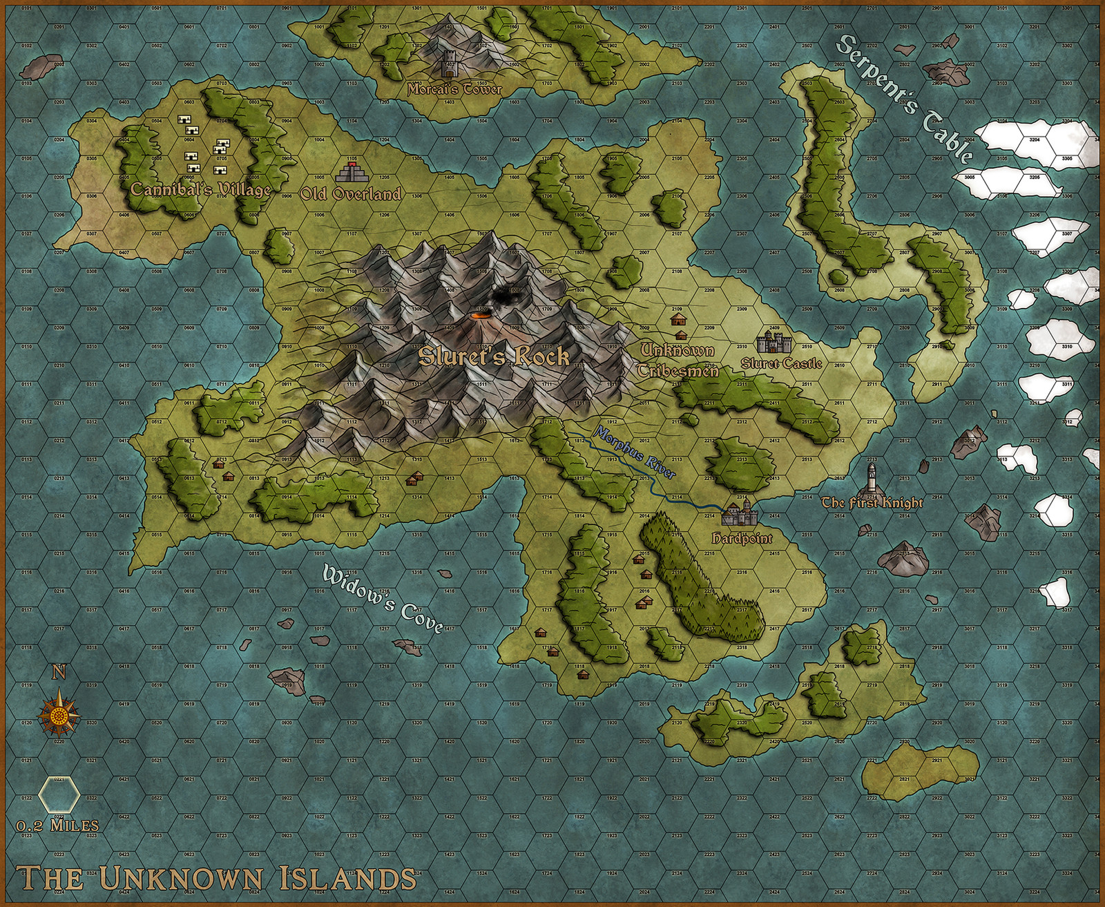
Another map made in GIMP. A little bit better this time (and with some islands to make it a little bit more entertaining). As usual free download provided for non-monetary use - just add appropriate reference (link or my full name). Prints are also possible to buy (because why not). I approve all comments, especially constructive criticizm!")
Related content


Comments: 18

👍: 0 ⏩: 0

 (Smile)")
*Turns into a Biscuit*
👍: 0 ⏩: 0

So,what happened to earth?
Big flood?
👍: 0 ⏩: 1

Well, as usual it depends on the narrative. Religious leaders will most likely say something about punishments, the sky on fire, pissed of gods and chosen ones. Scholars will point out melting glacials, a collision with some sort of comet or even extraterrestial life as a source of changes. Leaders will blame each other and wage wars between them. A common folk won't care at all because it's not relevant to their current lives and everyday struggles. The world lives on and as long it won't happen again everything is fine......
In short, I have no idea
👍: 0 ⏩: 1
I see.
In fact,the science and the authority for the interpretation of a doom is alway connected to political powers.
👍: 0 ⏩: 1
Yep, more or less ")
👍: 0 ⏩: 0

Great minds think alike! I did a higher-water-table take on the Middle East a while back (see it here ). Your climate changes are fascinating! I also like how you did the rivers.
I do have a couple of suggestions. The first is to consider doing some bump mapping (Filter-Map-Bump Map, play with the elevation levels). My other suggestion is to make the coastlines a bit less boxy. At 100% zoom I'm seeing a lot of squares.
All in all, a great map!
👍: 0 ⏩: 1
Wow, Your map is pretty cool, I must admit  (Wink)")
Rivers were just "cut" through land/vegetation/hills layers - some based on real wadi/river beds, some totally fictional. Because the idea was to create a map looking roughly similar to the google map view perspective rivers shows only their "lowland" course.
I tried some bump mapping before, sadly with unappealing results. Sill, I think to go back to the idea in the near future. The boxiness is what I struggle with now - I can always do some blurrying in order to make the borders less sharp, but in the same way I loose distinct coastline...
Thanks
👍: 0 ⏩: 0

Looks a lot like the Arabian peninsula and Iran after a massive rise of sea level. Very nicely done!
👍: 0 ⏩: 2

Yes. I noticed the Sinai peninsula, the Red Sea, the Arabian Peninsula, and the Persian Gulf right away.
👍: 0 ⏩: 1
Yep - I always wanted to do a map that's based at least partially on the Near/Middle east topography. The only question was "should I rise or lower the sea level?" Rising seemed a better choice
👍: 0 ⏩: 0

More-or-less yes. The coninental outline was done basing on the greyscale map of the Earth (everything above 50m = colour, less = no colour). The final effect is, I guess, rather pleasing
👍: 0 ⏩: 0