HOME | DD
 HvallaAdmin — Detail Map: The Caldera

#hvalla
Published: 2021-02-15 04:19:48 +0000 UTC; Views: 1413; Favourites: 16; Downloads: 0
Redirect to original
Description
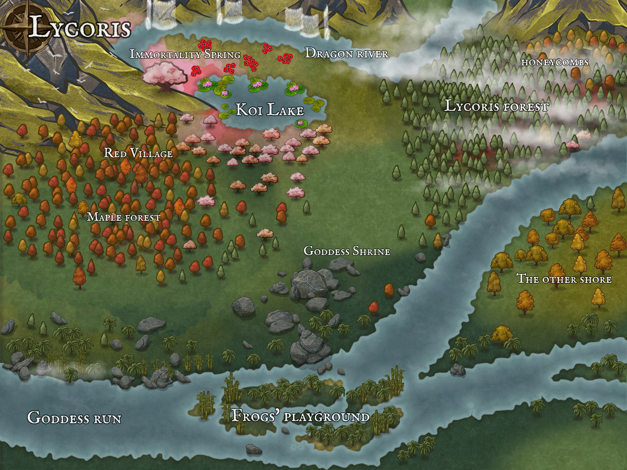
Detail Map of 'The Caldera' Landmark in the Utgard Subzone.All of these areas and locations fall under 'The Caldera' landmark in the 'Wargrun' important area.Landmark Name: The Caldera
Location: Utgard
Description: The Caldera is a huge lush valley formed inside the long dormant volcano Ormvardir. Filled with fertile farming land, all roads lead to the Capital City of Wargrun at its center.
Points of InterestBrightstone Village
A farming settlement just outside the city walls. Clan Brightstone once owned and managed the surrounding fields, renting out property to wargs willing to work the land. Since the Cataclysm, the ruins of the village can be seen from the south end of the Drekar Wall.
Hangaar Village
A small hunting village in the woods at the rim of the caldera in the south. Prior to the Cataclysm, they were known for their festivals and rich gameland.
Osle Village
A fishing village that sits on the northern part of Dragonfall Lake. Often obscured by heavy fog, its status in the aftermath of the Cataclysm is unknown.
Dragonfall Lake
A deep lake that buttresses the steep cliffs of Wargrun's walls. The bones of fallen dragons can be seen in the crystal-clear waters
Wargrun
The Capital City of the Stonewarg.
NOT FOR FREE USE — ARTWORK PROVIDED FOR Hvalla