HOME | DD
 IainFluff — NAmap
Published: 2013-05-16 14:05:54 +0000 UTC; Views: 2749; Favourites: 17; Downloads: 191
Redirect to original
Description
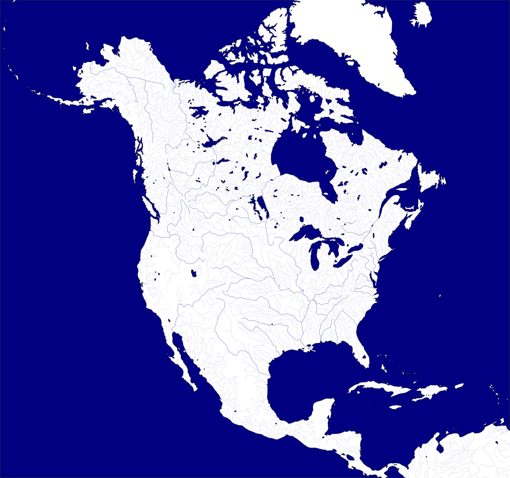
Enough (lazy ass (Wink)") ) people have asked me for this over the years I should probably just throw it up here. 3122x2931 SVG tracing of the coastlines and river systems of the 'Watersheds of North America' source image.
) people have asked me for this over the years I should probably just throw it up here. 3122x2931 SVG tracing of the coastlines and river systems of the 'Watersheds of North America' source image.
Related content


Comments: 11

👍: 0 ⏩: 0

I wish I weren't so tech incompetent. I can't figure out how to get this into GIMP or Paint or whatnot.
👍: 0 ⏩: 0

OMIGURD OMIGURD OMIGURD
THIS IS PERFECT FOR MY AMERICAN WARRING STATES STORY/MAP!!!
👍: 0 ⏩: 0

")

")

 (Smile)")

Ouch, that must have been fun 
👍: 0 ⏩: 0


Do you mean the current modern borders? No I never bothered to trace those for map production - just use the basemap (example link below) to guide if you want that.
[link]
👍: 0 ⏩: 1