HOME | DD
 SirJoshizzle — Hyrule Kingdom - Political
Published: 2008-08-15 20:17:22 +0000 UTC; Views: 6932; Favourites: 23; Downloads: 2746
Redirect to original
Description
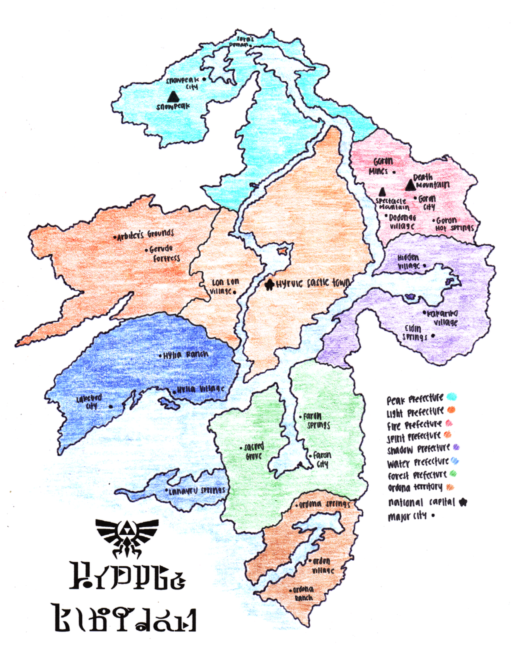
A concept map I created of the Hylian Kingdom, showing all the cities and political divisions of Hyrule.This Hyrule takes after Hyrule as seen in Twilight Princess with some obvious original concepts. Compared to my older map of Hyrule [link] this one is much more massive and more vertical-oriented than horizonally.
Hyrule here is divided into seven prefectures (like the old map): Peak, Light, Fire, Spirit, Shadow, Water, and Forest (Peak Prefecture here replaces the old Hyrule Field Prefecture). They're all color-coded in their prefectural color. Obviously, all except Peak Prefecture is named after their respective element represented by one of the six sages. Additionally, there's another division south of Faron Prefecture known as Ordona Territory, an annex to Hyrule proper (mirroring that Ordona in Twilight Princess wasn't actually a part of the country of Hyrule).
If I were to rank them by population is descending order, they'd be Light, Shadow, Water, Spirit, Peak, Fire, Faron, and Ordona. By size, it's Light, Water, Peak, Spirit, Faron, Shadow, Fire, and Ordona.
Should I ever do another AU Zelda story, this will be the Hyrule used.
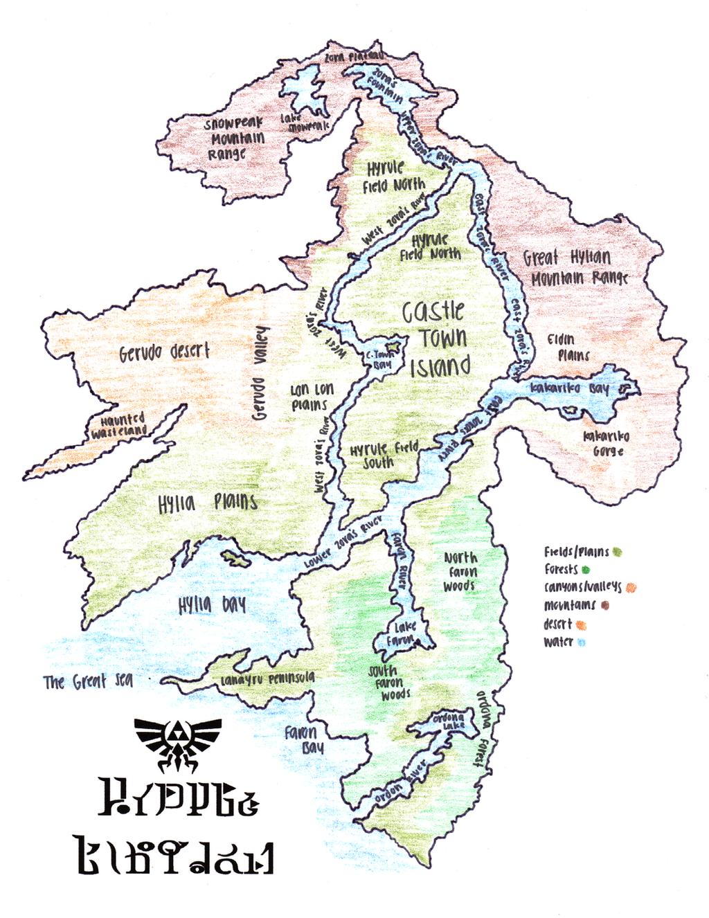
Hyrule Kingdom
Physical map - [link]
Transporation map - [link]
Regional map - [link]
Enjoy Life and Smile.
Related content


Comments: 2


Awesomely awesome, man.
Hope to see another AU Zelda story from you soon.
👍: 0 ⏩: 0