HOME | DD
 SirJoshizzle — Hyrule Kingdom - Physical
Published: 2008-08-15 20:17:27 +0000 UTC; Views: 4344; Favourites: 29; Downloads: 134
Redirect to original
Description
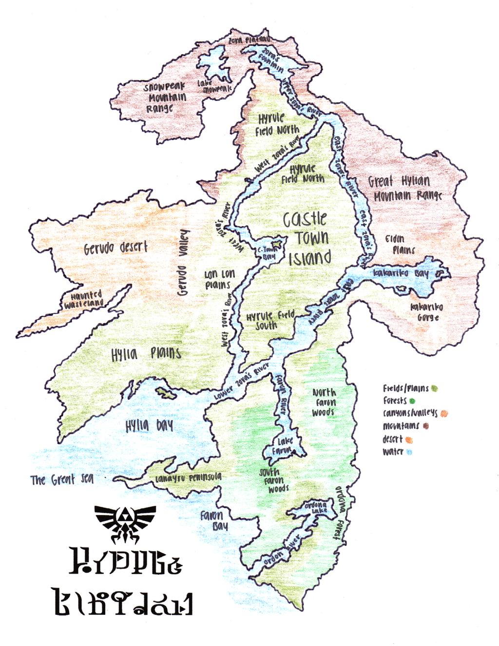
A concept map I created of the Hylian Kingdom, showing all the geographical features of Hyrule.This Hyrule takes after Hyrule as seen in Twilight Princess with some obvious original concepts. Compared to my older map of Hyrule [link] this one is much more massive and more vertical-oriented than horizonally.
Some of the more noticeable changes is that there's a massive island in the middle of the country, bordered by Zora's River on all sides. Zora's River begins at Zora's fountain in the north, splitting off at the end of North Zora's River into East and West Zora's River, joining together at Lower Zora's River, then emptying into Hylia Bay. East and West Zora's River feed a bay: Kakariko Bay and Castle Town Bay respectively. East Zora's River also has a tributary known as Faron River, which feeds Faron Lake. Ordona Territory has its own lake and river, Ordona Lake and Ordon River, which empties into the Great Sea.
Lake Hylia, like in my old Hyrule map, is now a massive bay that pours into the Great Sea, only this time it doesn't retain its name Lake Hylia.
Two mountain ranges dominate Hyrule to the north and northeast: Snowpeak Mountain Range and the Great Hylian Mountain Range respectively. Both contain Hyrule's three tallest mountains: Death Mountain, Spectacle Mountain, and Snowpeak respectively.
Plains dominate the heartland: Hyrule Field in the center on Castle Town Island (broken into two parts known as Hyrule Field North and Hyrule Field south), Eldin Plains to the east, Lon Lon Plains to the west, and Hylia Plains in the southwest between Hylia Bay and the Gerudo Desert, which is separated from Lon Lon Plains by Gerudo Valley.
Valleys and canyons are in the far east, with Kakariko Gorge being the largest of them, situating Kakariko Village in the middle of a large canyon.
Should I ever do another AU Zelda story, this will be the Hyrule used.
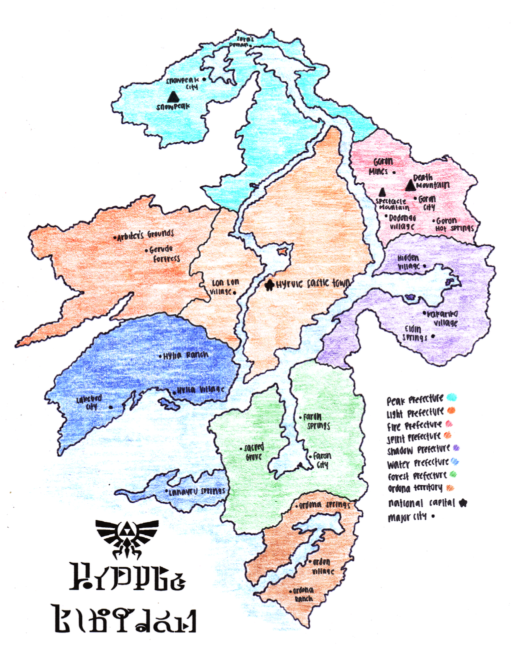
Hyrule Kingdom
Political map - [link]
Transportation map - [link]
Regional map - [link]
Enjoy Life and Smile.
Related content


Comments: 4

")

Their could techneclly be two versions of TP Hyrule, cause the one in the gamecube version was backwards from the wii version.
👍: 0 ⏩: 1

This one obviously takes after the GameCube version. Even though Nintendo markets Twilight Princess for Wii more, I think they (and a lot of other people) consider the GameCube version the canon one. Miyamoto said that the mirroring in the Wii version was purely technical so the motion controls were more suited to righties, and lefties were able to adapt to it than if a right handed person were to use their left hand, after all.
It didn't really matter to me, because I played TP with my left hand the entire time. I'm a complete handicap when using my right hand. xp
...Except on some things.
")
👍: 0 ⏩: 1
ya, my friend just told me that one day cause I played it on the cube, I didn't get my wii until some time later.
👍: 0 ⏩: 0