HOME | DD
 TitaniumTurt1e — AtlantisElevation

#atlantis #elevation #map #richat_structure #eye_of_the_sahara #sahara
Published: 2020-12-09 10:18:08 +0000 UTC; Views: 754; Favourites: 12; Downloads: 2
Redirect to original
Description
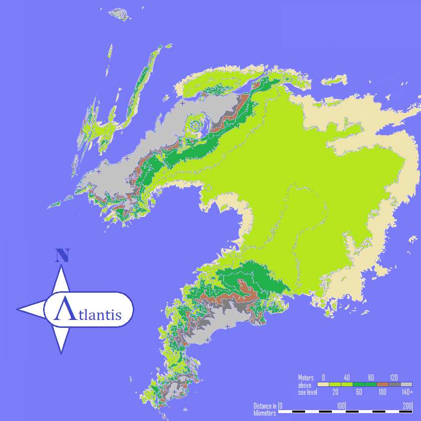
This is a follow up to my previous map of Atlantis here .I should add that this is all speculation based on a niche theory that I just felt needed a little more fleshing out to satisfy my own curiosity, and I did this in MS Paint.
I cleaned up the flood maps some and overlaid only every 20m rise in elevation instead of 10m like before. The color scheme isn't any indication of climate, only elevation. It changes more frequently as the elevation gets higher because the two mountain ranges get steep very quickly. I would imagine they would look somewhat comparable to the Cliffs of Dover on the north and south sides of the island, mostly at a comparable height. I marked the 3 highest peaks of each range with a +, the highest being the western most at about 350m above sea-level (as depicted) followed by the northern most at about 250m.
I've probably gotten too technical with this, but I intend to clean it up a bit since it is still a bit sloppy in a lot of places, especially where it gets steeper. I am going to do a more detailed cleanup of the city proper area(Richat Structure/Eye of the Sahara), probably including a guess as to where the canal could have existed.
Any comments or criticism, good or bad, are appreciated.


