HOME | DD
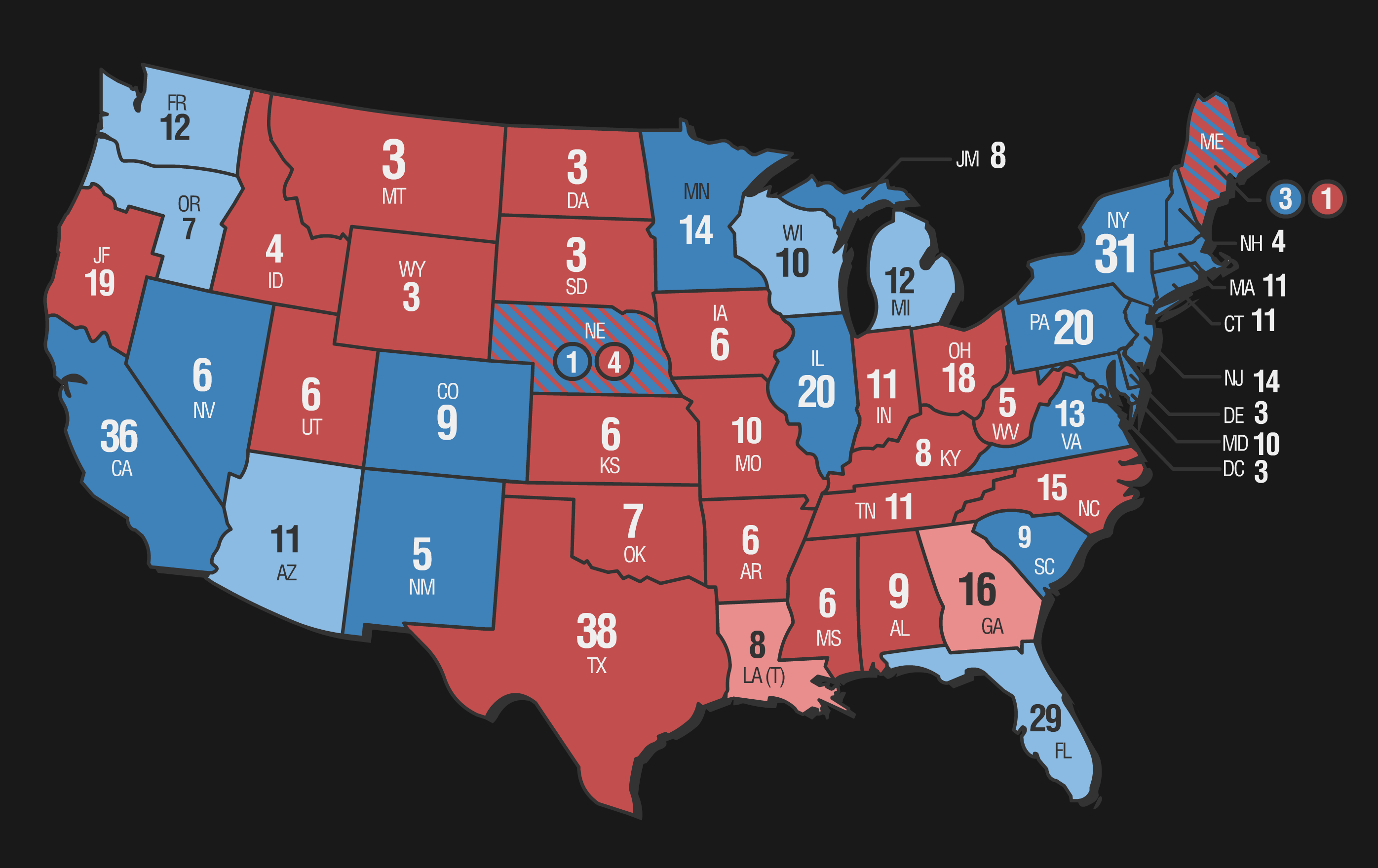
 TrulyLimboGene — LiVES: Map of the 2021 U.S. Election
#limbogene #khryogenical #trulylimbogene #alternatehistory #alternateuniverse
Published: 2021-01-25 16:10:25 +0000 UTC; Views: 2377; Favourites: 7; Downloads: 0
Redirect to original
Description
Disclaimer: The purpose of this map is entirely for entertainment use and is not meant in any way to be used in an educational setting! This is not a map that contains biased results that is meant to sway an individual towards a republican or democrat!
48 States. 1 Country. 1 Nation. The citizens of the United States decide on their next representative for the country.
Quick rundown of stuff that's different:
• The (DC) District of Columbia is a state, that surrounds the federal district. Has been since 1993.
• Vermont merged with New York in 1778.
• Island of Connecticut (CT) merged with Rhode Island in 1862 due to the American Civil War in an effort to re-stimulate the economy.
• Due to the failing economy of the U.S. after the Civil War and assassination of several presidents consecutively, the incumbent decided to be conservative and not reach out to farther lands. Therefore, the Russian Empire kept Alaska and battled disputes with Canada, until 1917 when the Russian Revolution transformed the nation into a communist state. The landmass later succeeded from the Soviet Union to form Alysaka Republic. Its population consists of Russians, Americans and Canadians.
• Hawaii was a U.S. Territory since 1900 until the bombing of Pearl Harbor from a combined air force of Japanese, Germans and Italians in 1941. With admission into WW2, the islands were split among the three for half a decade until the Axis defeat—treated as a colonial territory like many other islands across the globe, they declared independence from the U.S.A. in 1949. Consisting of Japanese, Germans and few Americans, what was once a chain of islands was now a major hub of international cultures.
• (JF) Jefferson split off from Oregon and California as did (JM) Madison from Michigan to create two new states in 1959.
• Louisiana is not a state, but instead is still a territory. Supporters of Louisiana statehood have existed since 1951 and Congress gave them electoral college votes for primary elections. However, politicians throughout the decades have blocked the bill in order to prevent them from tipping balance between republicans and democrats.
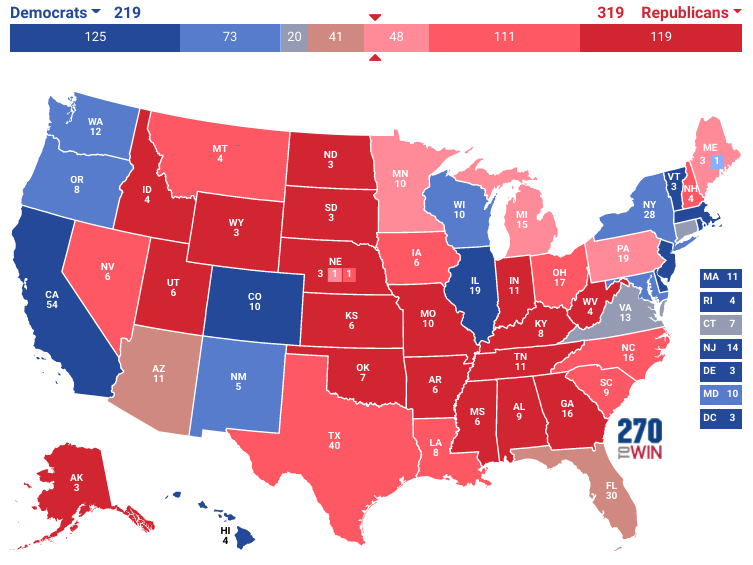
Although it deeply resembles our world, it's not the same. Check out this to see the changes.
Took a while to produce this one. Had to do a lot of excel spreadsheets that calculate realistic electoral college votes and landmasses that would sway to each opposing party. So yeah... did some homework for such a tiny project. The candidates will be revealed in a future artwork. (although its obvious who they are)
Since the comics really take 1 year ahead of our timeline and most major events are shifted, here's the map finally of how the election went. This is more of an updated version of this map, which depicted an alternate history of the U.S. slightly different to ours. I am planning to release a map of the whole world which is also an alternate history of Earth 3, so get ready for controversies to begin.
Been really loving the alternate history contexts, so I will be working with that a lot in the future!
Related content


Comments: 5

Madison wouldn't be JM and Island of Connecticut wouldn't be CT. A main point of the abbreviations is that they start with the same letter as the state. Island of Connecticut would probably be IC, which makes sense, but Madison would be harder since there are already too many M states and all the other letters in the name are taken. Maybe in the initial abbreviation process the give MI to Madison and Michigan gets MG?
👍: 0 ⏩: 1

👍: 0 ⏩: 0

👍: 0 ⏩: 1
👍: 0 ⏩: 0

👍: 0 ⏩: 0