HOME | DD
 AMCAlmaron — Map Of Pern
Published: 2011-06-16 22:57:44 +0000 UTC; Views: 2728; Favourites: 6; Downloads: 40
Redirect to original
Description
EDIT: Updated - Go Here:[link]
You'll probably have to download this one to see it.
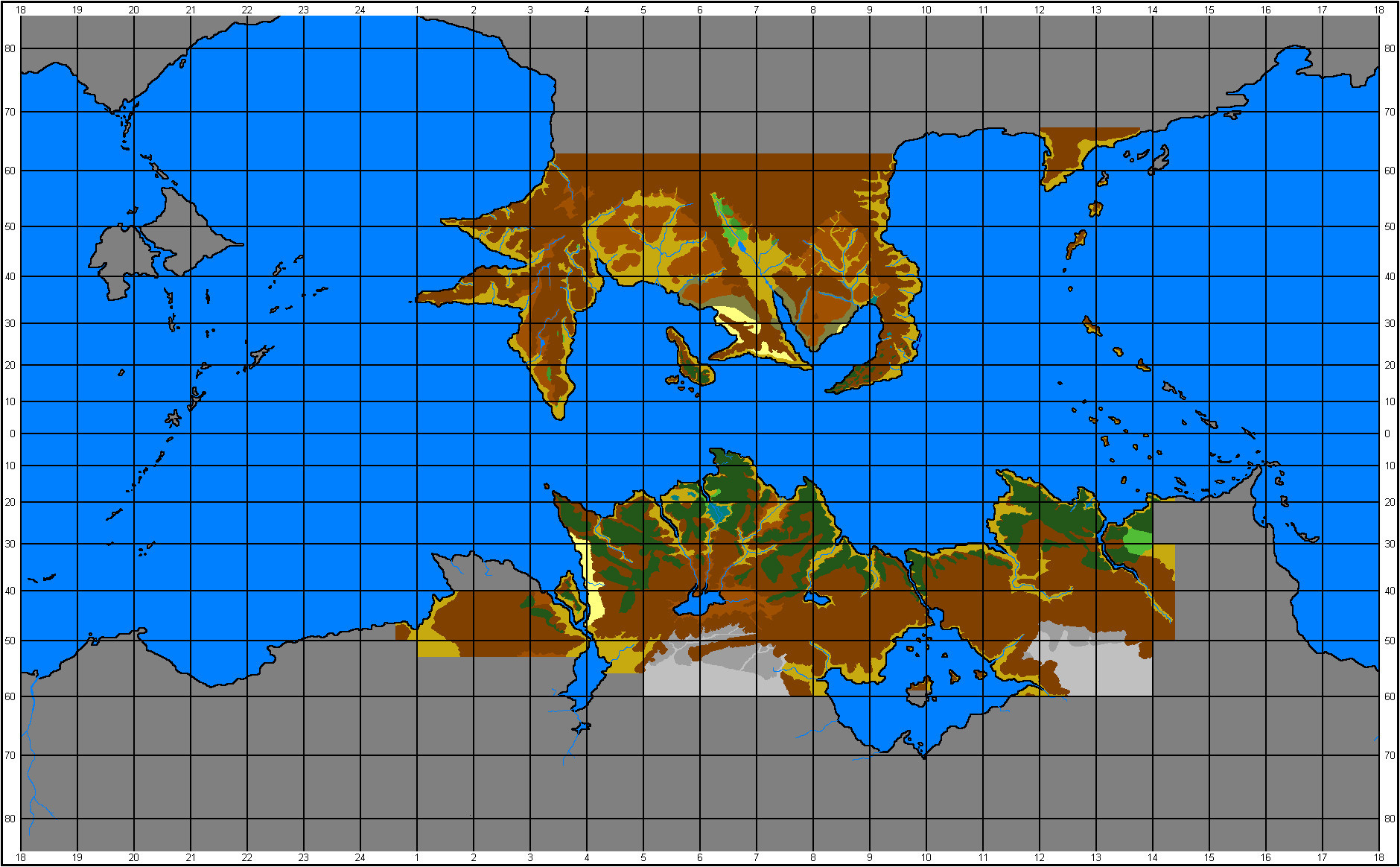
This is the current stage of a project I started in late 2008, and only now got around to finishing! The Atlas of Pern did a beautiful job of illustrating the world of Pern, but it was last published in 1985, and quite a fair bit has changed since then. Using information from that, as well as from the many maps published in the books (which can be seen here [link] I drew up this pixelly terrain map.
Although I haven't labelled this version (there's quite a few earlier versions of this with labels, but I was having trouble with the layout, so I've left it blank for now), my plan was that this simplified pixel version could be quickly edited as new information is discovered, such as hold locations - the map in the cover of Skies of Pern is quite out of date; there should be at least 24 holds under Southern, the Weyr has moved, and Paradise River is certainly a major hold by now.
One problem I had with the Atlas of Pern is that it doesn't always differentiate between a mountain and a tall hill, so this version's a bit off in places. Some areas I had to guess at, because the maps contradicted one another, or I couldn't see what was supposed to be there.
Light Brown represents Sea Level, Brown represents Highland, Dark Brown represents Hills/Mountains. Greens represent tree growth. Teal represents marshes. Pale Yellow is Desert. Dark Yellow is Steppe. Greys either represent snow on varying levels or unmapped areas.
I didn't draw the base of this map myself; back before I was familiar with the proper protocol of picture editing, I just grabbed a random image and started tracing over that. The base image is this [link] and I believe is from the Xanadu Weyr site, but I am unable to find that picture on their site or find a way to contact them.
That's one reason that finishing this took so long; I realised halfway through that I needed to credit the original author, and I was unsure of what to do next, as I still wanted people to be able to use the terrain map, in part so that people could accurately design MUSH locations. If somebody from Xanadu Weyr could check with them and see that they're ok with me using their image, I'd be grateful. If they're not happy, I'll delete this.
Dragonriders of Pern copyright Anne and Todd McCaffrey
Atlas Of Pern drawn by Karen Wynn Fonstad
Other maps drawn by various artists
Map Base by Mynti [link] based on a map by Niels W. Erickson and Harry Alm