HOME | DD
 Caenwyr — The Dragon's Backbone and Surrounding Lands

#cartographer #cartography #fantasy #map #mapping #maps #regional #cartographersguild #caenwyr
Published: 2018-12-10 15:09:56 +0000 UTC; Views: 3066; Favourites: 37; Downloads: 0
Redirect to original
Description
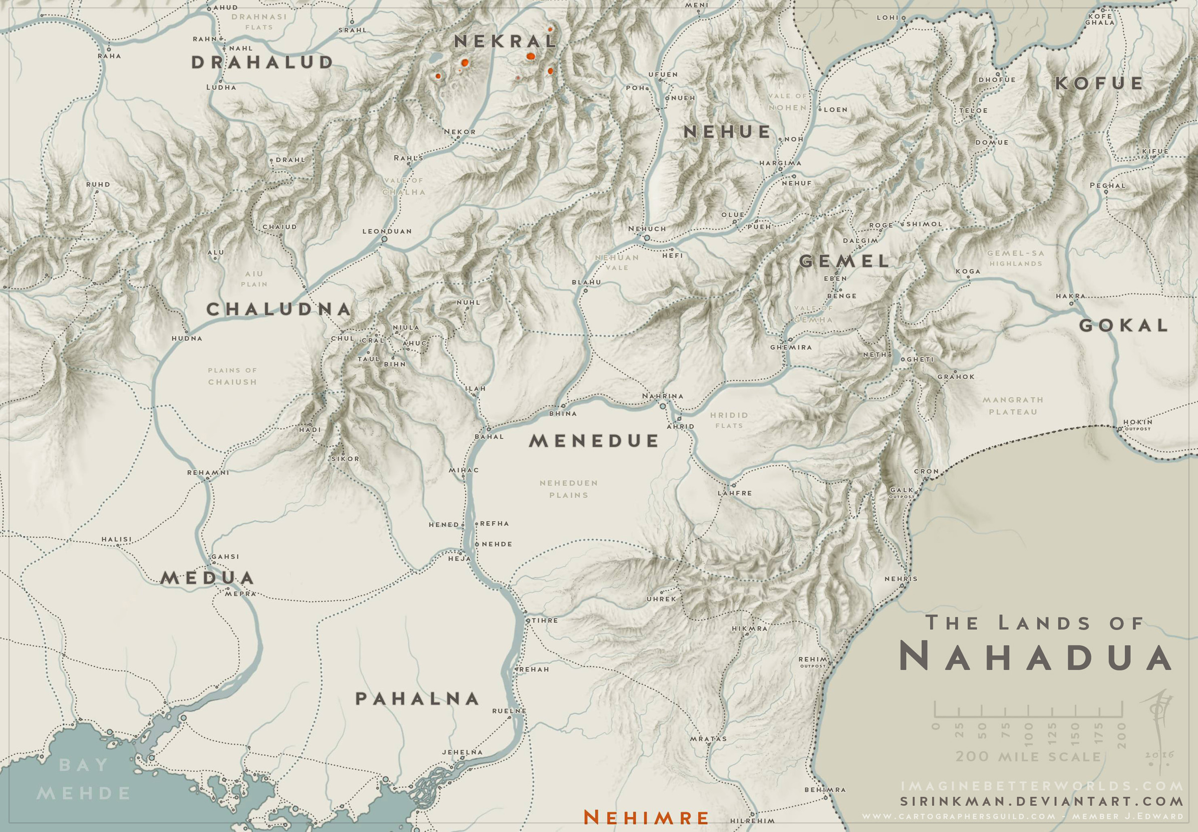
This map is the second in a pair that will be used in my upcoming fantasy novel "The Exile" (the first installment in a larger series that will eventually come to be called "Chronicles of the War of Blood and Darkness"). The first map showed the civilised lands of Aran & Ilan, and the sparsely inhabited Outer Reaches of the known world. This map zooms in on a section of the Dragon's Backbone, the region where most of the action will take place.The Dragon's Backbone starts as a rather low, easily passable ridge in the south, but gradually works its way up to soaring peaks and terrible chasms, before ending in a series of humongous cliffs dropping into a huge glacial lake. The country of Faltorn takes up the passable part of the mountains in the south. North of that, the mountains form the border between Aran (the lands to the east) and Ilan (the lands to the west of the mountains). Several passes allow passage from one to the other, but most are very remote and seriously difficult to cross. There's only two passes that actually allow armies to transverse the mountains:
- the Iron Pass in the south: once the trajectory of trade caravans, later becoming a battleground, which in the days of my story evolved into an abandoned wasteland only visited by reconnaissance units from both sides due to a successful treaty between the regional power centers on either side of the pass (this pass is named Sir Rẃidic in the High Tongue and Sgárni Privu in the Thieves' Tongue); and
- the Evening Glow Pass 200 miles to the north: a terrible, terrible route clinging to sheer cliffs and crossing treacherous glaciers. This second pass is still used for invasions from both sides, and abandoned every fall due to the dropping temperatures. Attempts have been made in the past to construct fortresses to withstand the horrible cold, but no one ever succeeded (this pass is named Sir Áinglaran in the High Tongue and Díshuda Privu in the Thieves' Tongue).
Except, that never happened. Gaendyr turned into a scrawny little nation of warriors, squeezed between the immovable Araniell and the continuously invading peoples from Ilan, but it managed to survive. Barely, but it did. And eventually people from beyond the border began to send help too. Never in the shape of goods or gold, since these were strictly prohibited by the Araniell government, but help they did. It became a matter of pride among the West-Araniell houses to send troops to Gaendyr. No longer to beat the locals in the dust but to aid them in their wars against Ilan. Brave and bold as that move was, it wasn't entirely selfless. Araniell nobles living close to the Gaendyr border realised that they either helped Gaendyr defend its western border, or would someday face the Ilan invasions themselves. And mountain passes are far easier to defend than a 1000 mile long stretch of river...
----------------
This is the coloured version of the map. Check out the B&W novel version too!
Related content


Comments: 6

Amazing map, I like the shadows of the mountains
👍: 0 ⏩: 1

Thanks a bunch Mike! I see you're quite the mountain man yourself ")
👍: 0 ⏩: 1

Absolutely awesome job. I love the colours and the mountrains are fab !
👍: 0 ⏩: 1
Hey thanks Rafal! Glad you like the mountains, those almost killed me
👍: 0 ⏩: 1
No wonder, i can only imagine how long time you must have spent on those.
👍: 0 ⏩: 0