HOME | DD
 Kvetchman — Tamriel Base Map v.3
by-nc
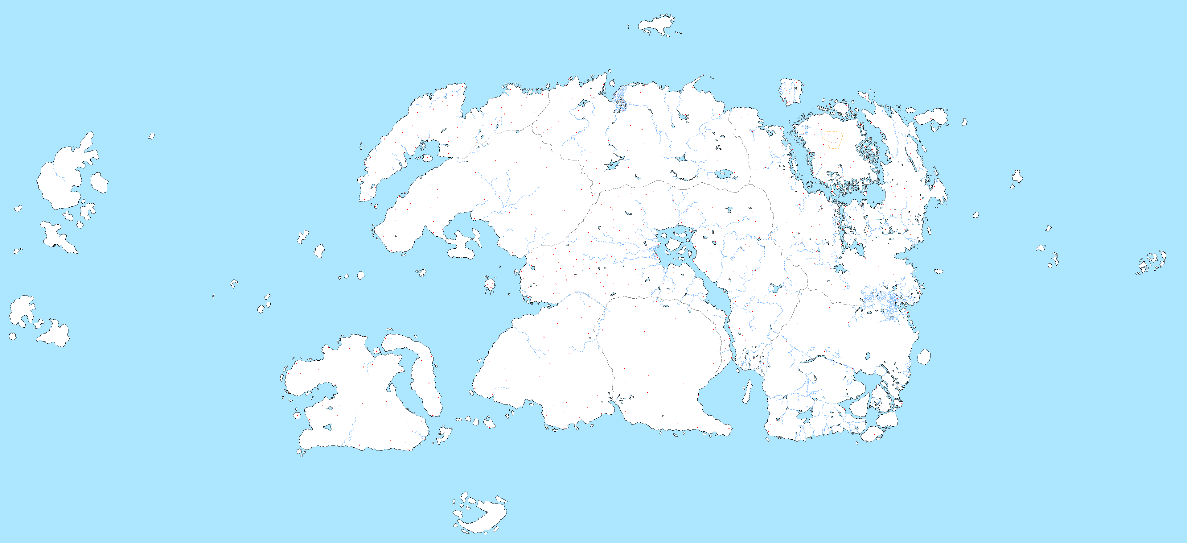
Kvetchman — Tamriel Base Map v.3
by-nc
#elderscrolls #maps #tamriel
Published: 2020-08-21 08:22:52 +0000 UTC; Views: 3302; Favourites: 33; Downloads: 68
Redirect to original
Description
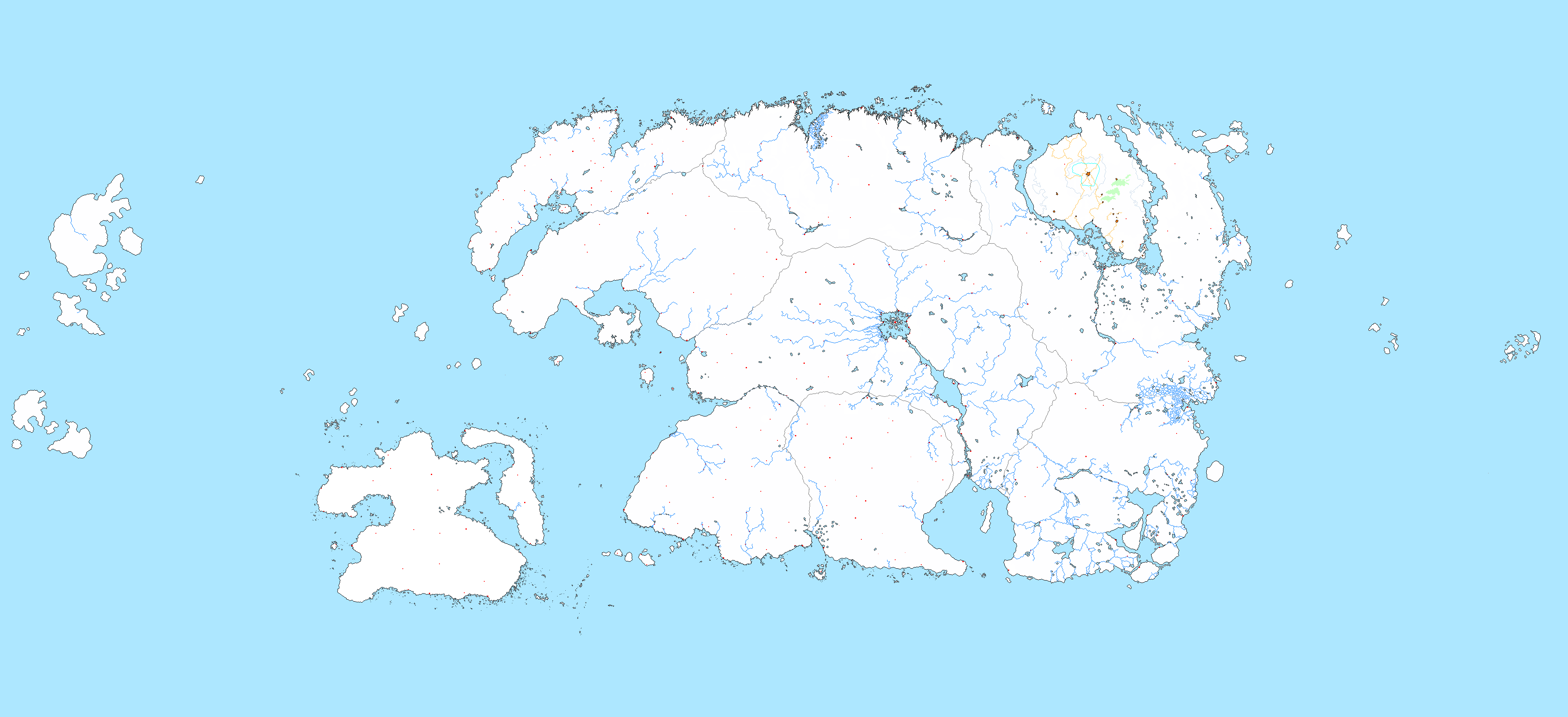
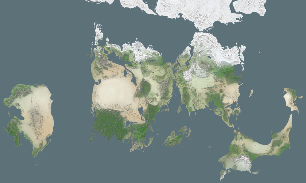
I have been working with the version 2 of the Tamriel basemap for quite a long time now. For an even longer time, however, I have thought about the problem of "real life" scale. Finally, I had enough; I stopped working on the language map to focus on the super huge maps, of which I have finished Summurset Isle, Valenwood and Elsweyr so far. But realistically speaking, that's something that will take years to finish, and it's not very practical to use. So instead, I went back to my original "big" basemap. But instead of just changing some rivers and islands to make them a bit more realistic (so that the Imperial City isn't a billion-inhabitant metropolis sprawled across a France-sized Rumare Sea), I decided to go a step further. Cue, Version 3.The main idea behind this map, apart from the aforementioned fixes to elements that are problematic scale-wise, was to truly draw Tamriel in my vision of what it looks like - not what the canon maps show, nor what any of the major Morrowind mod projects show, but something that I thought looked nice and in line with my headcanon (shameless reminder to check my pastebin under the same username). I leaned heavily towards Arena-era province shapes but I incorporated ESO detail and just my own work.
The biggest change that your eyes will probably avert to first is Morrowind, more precisely Vvardenfell. All of Morrowind is based on the old Morrowind concept map along with Arena's map for some detail.
High Rock, too, is much more buff compared to its old representation, courtesy of Arena. Its northern coast, however, is mostly based on ESO and just general conjecture.
Skyrim's main change is in its detailed fjord coastline. Its river systems conform to the province's largely mountainous, northwest-southeast-oriented interior. The Reach, the land of canyons and mesas, is oriented southwest-northeast. The Rift features a long lake and river system. I thought the swamps of Hjaalmarch were interesting enough to be kept in.
Hammerfell's main changes come in the reshaping of its western coast to be more in line with the Arena map, as well as a major change to Hew's Bane. Humouring the old representation of Hew's Bane as Little Summurset, I decided to use the shape of Summurset from the ancient Redguard-era West Tamriel map but with the original eastern peninsula (the horn) from that map's Hew's Bane, as well as adding ESO detail.
Summurset Isle itself has been completely redrawn in line with its original Arena depiction. What can I say, I just like that slick shape.
For Valenwood and Elsweyr, check out the huge basemaps I uploaded of them. I won't go in detail here because I've mostly written everything already.
My main change to Argonia was a decrease in the province's "width". Additionally, Soulrest is now located on a nice horn of a peninsula, as it once already did (but also not because the devs had to move it so as to be able to fit it on the map). The original waterways that I decided would warrant showing much of the southern land as islands has been shifted back to simple rivers.
Finally, there's Cyrodiil. Pursuing the policy of scaling down landmarks for consistency and realism, I scaled down Lake Rumare, Niben Bay and Niben River dramatically. More rivers have been added to the province and I changed the Imperial Isles completely to make them unique and not based on any previous creation.
This map should be adequate for now, although I will certainly add more rivers and islands to it, and I am also planning on adding other associated lands to it, primarily Roscrea and Pyandonea. My language map project is also moving to this basemap.
Related content


Comments: 2

👍: 0 ⏩: 1

👍: 0 ⏩: 0