HOME | DD
 n-a-i-m-a — Argolis Island 3d terrain test
Published: 2018-02-26 14:57:33 +0000 UTC; Views: 953; Favourites: 8; Downloads: 0
Redirect to original
Description
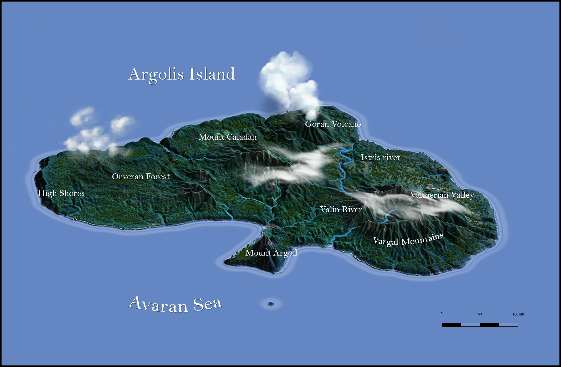
Hello , this is totally a test , nothing special really , I invented the names in less than a minute and I created this map to test isometric 3d terrain generation tool for photoshop .The island is a real topography from an exhistinc Island I forgot wich one, I think is one of the island north of New Zealand.
Related content


Comments: 3


Thanks but is not a rendering , its a multilayered perspective view made in photoshop from heightmap grayscale levels.
👍: 0 ⏩: 1