HOME | DD
 Pyrosity — Regional Map - Rrustam Vana
by-nc-nd
Pyrosity — Regional Map - Rrustam Vana
by-nc-nd
Published: 2014-04-04 08:24:26 +0000 UTC; Views: 1678; Favourites: 22; Downloads: 11
Redirect to original
Description
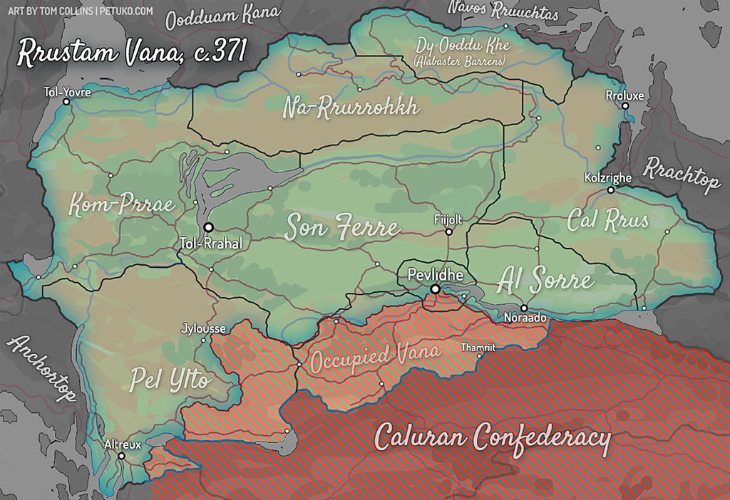
Been poking at this in between commission work. Still not sure quite how much/what information I wanna show on a regional map like this (and it may depend on the map) but it’s a start. Dark interior lines are state/provincial borders (their names in the large cursive typeface), and the red lines are the major road/rail infrastructure. Dots are obviously cities (and large towns), with the largest/most important ones named. For example, Pevlidhe (“Pev-lid-ay”) is the capital, while Tol-Rrahal is the most populous city. Thamriit is Alexa’s hometown—the same one where her parents met an unfortunate end in her teenage years, leaving her an orphan at 15.
Here’s the big map for context