HOME | DD
 vorropohaiah — ATLAS ELYDEN - #6: a map of Skaros
#cartography #fantasycartography #fantasymap #map #worldbuilding #elyden #atlaselyden #vorropohaiah
Published: 2016-05-11 16:46:09 +0000 UTC; Views: 6649; Favourites: 85; Downloads: 99
Redirect to original
Description
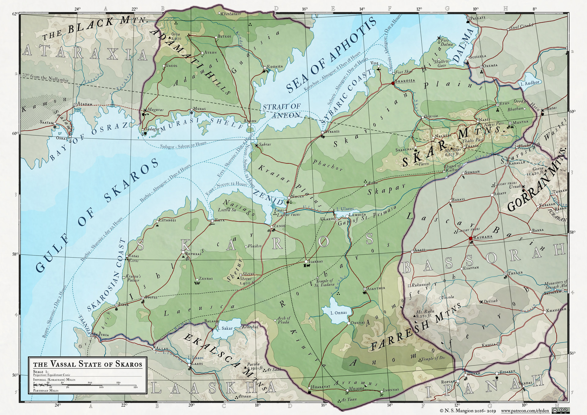
The latest map in my Atlas Elyden project - Skaros:
C&C are more than welcome, and remember, you can follow my patreon for high-res maps, textless maps, more details on the world and other exclusive content , thanks
A key/legend to the map can be found here
___________________________________________
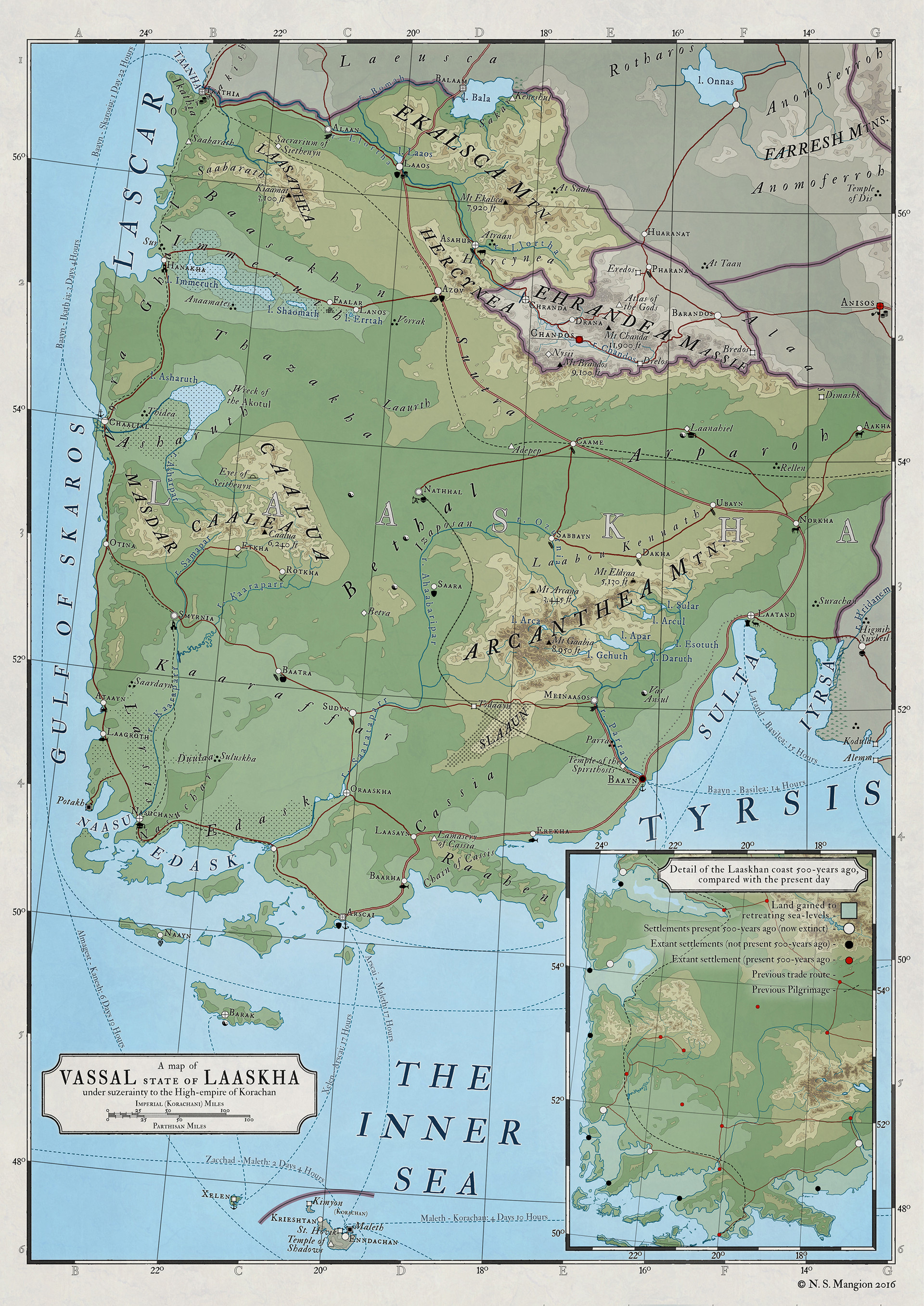
Skaros is a land with a long history, dating back to the dawn of the Fifth Age of mortal life, where the lascar people settled the eastern coast of the Gulf of Skaros. They prospered, spreading to the south and east before outside powers in the east stalled their growth. They would dwindle, their ancestors becoming the forebears of Laaskha and Bassorah, as well as Skaros.
By the coming of the Korachani empire, Skaros had become a powerful region with a history of charismatic, if ruthless, leaders who had a propensity for wielding the Atramenta against follower and foe alike. This was further exacerbated by the Korachani exile of its ancient witch-rulers, the cheiroahin, into Skarosian lands. Many cities in the south-east of Skaros retain their old Atramental traditions.
The civil war, known now as the War of the Artifexes, left Almagest (to the north of Skaros) an independent nation, sundered from its once-parent empire, taking with it a large portion of Skaros’s northern territories - a blow Skaros never fully recovered from. Though it remains today a valuable part of the Korachani empire’s economy, it remains known to most around the Inner Sea as a land of occultists and shipyards, a stereotype its people fight hard to shed. In truth, the Skarosi people see themselves as the descendants of conquerors and explorers, and the finest Atramentists in the empire.
EDIT - I updated the main image, changing the hue/saturation to make the colours pop a bit more, and changing the mask around the nation to make it paler, as well as updating some geographical details to match withthe more recent maps in the collection
Related content


Comments: 16

EDIT - I updated the main image, changing the hue/saturation to make the colours pop a bit more, and changing the mask around the nation to make it paler, as well as updating some geographical details to match with the more recent maps in the collection
👍: 0 ⏩: 0

I'm curious as to how you manage to create your topography. It doesn't appear to be generated by any program or algorithm. I can only suspect handdrawn, but by what technique I can only guess. The idea that comes to my mind would be extremely tedious and time consuming, which I highly doubt is how you do it.
So...HOw U do0z iT?
👍: 0 ⏩: 1
um... one layer at a time by hand with a mask on a coloured layer using the selection tool filled with white. It IS extremely tedious AND time consuming, though I haven't had success with any automated process yet, so I stick with hand-drawing them. I do enjoy it though. If you have any suggestions please let me know  (Smile)")
👍: 0 ⏩: 1
I use a program called Wilbur to help with making physical terrains, with bump mapping and whatnot. But it still requires you to make the heightmap beforehand whether by hand or other process. One thing I like to do in making handdrawn heightmaps is by using the clouds filter(I use Gimp most of the time btw, not familiar with PS) to generate a random base then spraypainting with white (to raise elevation) and black (lower) the larger features of the environment, then using Wilbur to automate the process of Erosion and River carving. Wilbur works best with exaggerated features; you can always change the contrast between low (black) and high (white) later.
Once that's done, to create an elevation map in the style similar to your maps I use the Posterize filter, which takes an image and reduces it to a select number of colors, based on color ranges. A black and white Heightmap can have any number of grayscale levels in between, which gives the look of an Elevation map like yours (although less handcrafted). Any places I dislike I just alter by hand and then fill in the levels with simple Paintbucket coloring or use of layers (if I want smoother blending between colors).
Sadly though, I don't make maps as often as I should, given the amount I make, very few make it here on DA. The ones that do are often half finished or 'continuous references' for an online roleplaying game.
Perhaps I'll do a serious 'completed' map soon. Maybe then we can compare and contrast techniques more constructively.
👍: 0 ⏩: 1
I've used Wilbur before, though as I;ve already come up with the city locations and river locations etc, it's not very easy to use. It's fine if i was starting a blank slate with it but its a bit too late for that now for this world. Though It's a very good program. I did use it to create the features for a distant continent in the same world, one that I hadn't already fleshed out.
👍: 0 ⏩: 1
Do you use a pen-tablet or anything like that to make your maps? Or is it all with a mouse? Or handdrawn then scanned in?
👍: 0 ⏩: 1
So far I'm getting along OK with a bamboo tablet, though id like to upgrade it, but honestly i just use the stylus (no hot keys or anything like that) so i doubt i even need anything bigger/better, but the small tablet surface area gets a bit annoying at times.
The original world map was roughly drawn and scanned (only because i didnt own a tablet back then), though that's the only stuff I've done by hand for the map. everything else is entirely digital.
👍: 0 ⏩: 0

Another great addition to the atlas.
I loved seeing that big map on the Guild with these overlaid on it.
You have so much work ahead of you. But That just means we have a lot of great maps to watch develop.
👍: 0 ⏩: 1
Yep lots of work.... once I get the area depicted in that map done ill probably make a huge composite map, which will require totally new labels. It'll make for a nice map
👍: 0 ⏩: 0

Another excellent addition to your atlas series.
👍: 0 ⏩: 1
thanks, maybe i'll get a decent amount to actually be able to call it an atlas someday
👍: 0 ⏩: 0

Thanks, but there's another 5 like this, and hopefully a lot more in the pipeline
")
👍: 0 ⏩: 1
