HOME | DD
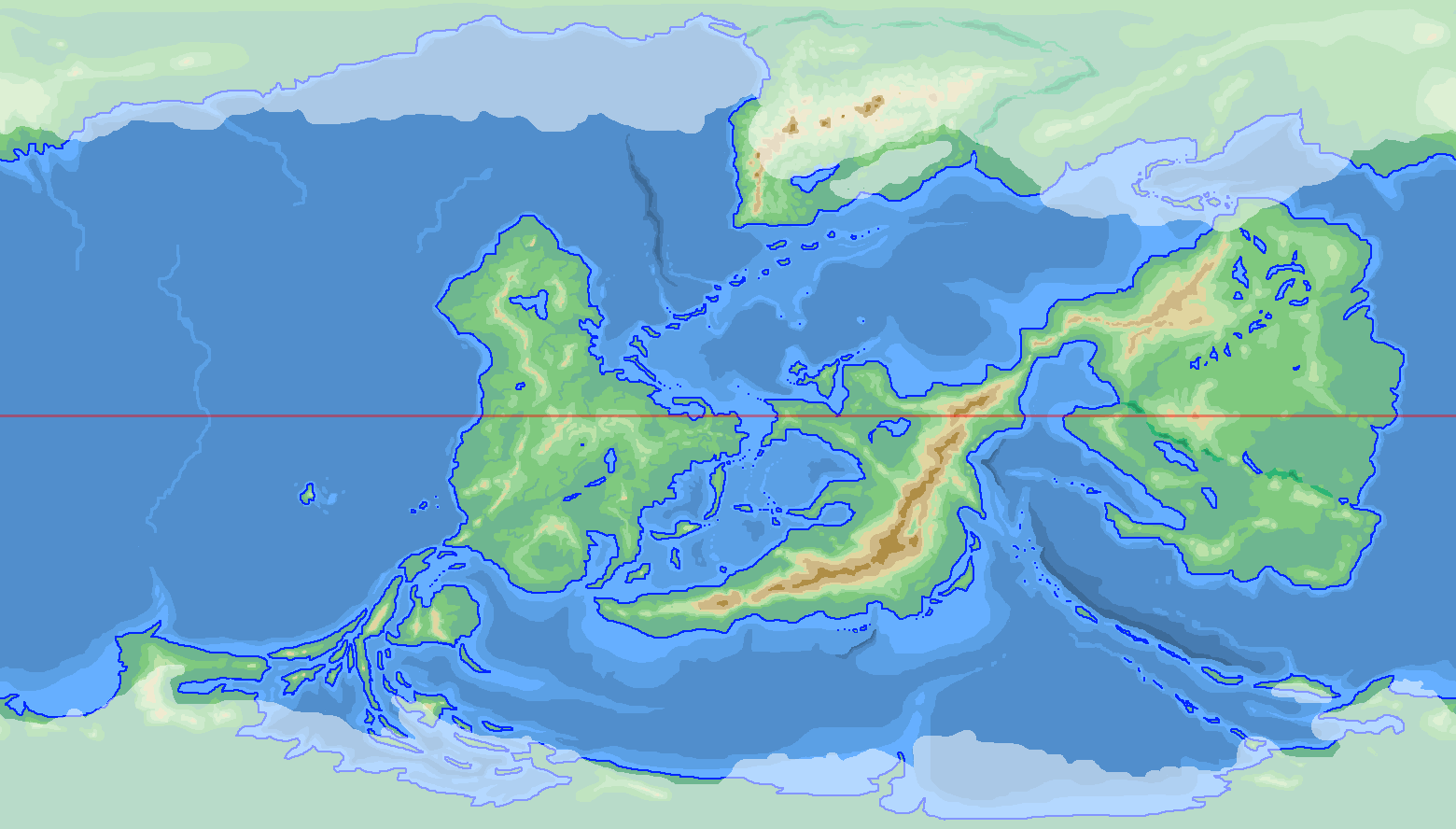
 tard15 — WIP World Map - Continent [ooh, what's left?]... 4

#continent #worldmap #alien_world #world_building #map #world_map
Published: 2019-03-27 04:33:28 +0000 UTC; Views: 2215; Favourites: 39; Downloads: 0
Redirect to original
Related content


Comments: 6

Interesting. How many of those rivers are navigable? Cause I can see some pretty massive civilizations springing up in that vast northern plain.
👍: 0 ⏩: 1

unfortunately, most of that vast northern plain is under a glacier ")
haven't really worked out the civilizations on this continent, other than that the Fjordy bits down the north-west coast are inhabited by a sort of a Vikingesque civilization...
👍: 0 ⏩: 1
Whoops! I was actually talking about the long river connecting that huge lake to the sea, plus the tributaries leading off to the east and into the central mountains. If that beast of a river is navigable the whole way down, it would be a huge economic asset, particularly since the tradewinds would make the whole downstream region pretty wet and fertile (assuming the planet has the same prograde rotation as Earth).
Then again, that basin off to the east seems rather isolated from the rest of the river system. Maybe there have been some upheavals over the centuries? An empire/rebellion cycle perhaps?
And yes, viking city-states in the fjords sounds very cool (As a Swede in exile, I highly endorse vikings!) And perhaps a nice Byzantine/Mediterranian style empire down south in that inland sea area?
Just some possibilities.
👍: 0 ⏩: 1
ah yes, that river is pretty much navigable all the way (pretty much i'm just showing the main rivers at this scale, and most of them are navigable). Spot on as to the wetness of the region - although there is bit of desert/grasslands stretching in from that big triangular bay on the eastern seaboard (hence all the transitory rivers).
Basin to the east... do you mean the one just below the 30th Parallel/the aforementioned triangular bay? Haven't really mapped that bit's history out in my mind yet.
Likewise on the southern inland sea, but yeah it certainly opens up possibilities for a bunch of little/large coast hugging nations and city states.
Thanks for your feedback!
 (Smile)")
👍: 0 ⏩: 1
Dammit, I meant the basin to the WEST! The one with the two small lakes. It would be just east of the viking coast.
(Not to self, do not comment while sleep-deprived.)
👍: 0 ⏩: 1
ah got ya... still, same answer really though = Haven't really worked out many details socio/politically for this continent. I can certainly see the potential for that area though
Interestingly (and oddly) this one continent is the one that i have really worked out the least of its history and civilizations (other that "a vikingesque civilization" i've got pretty much nada) whereas with all the others I've pretty much got... well, other than actual *names* for the countries... everything.
I really should have a sit down and just concentrate on 4 for a while in my head
👍: 0 ⏩: 0