HOME | DD
 tard15 — WIP World Map - Continent 1

#alienworld #continent #map #planet #worldbuilding #alien_world
Published: 2018-09-06 10:02:13 +0000 UTC; Views: 1472; Favourites: 34; Downloads: 0
Redirect to original
Description
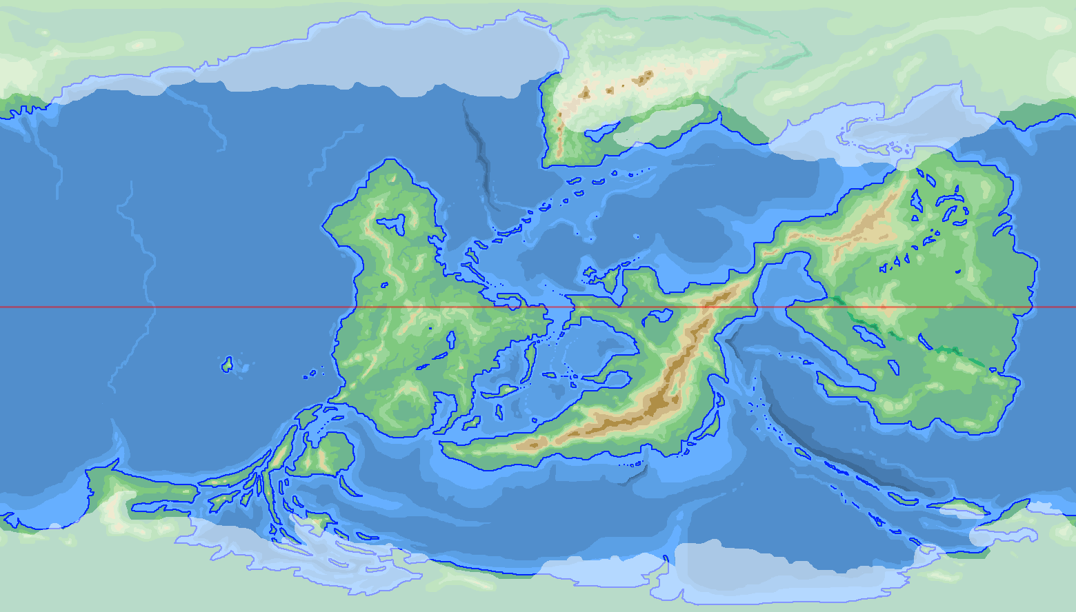
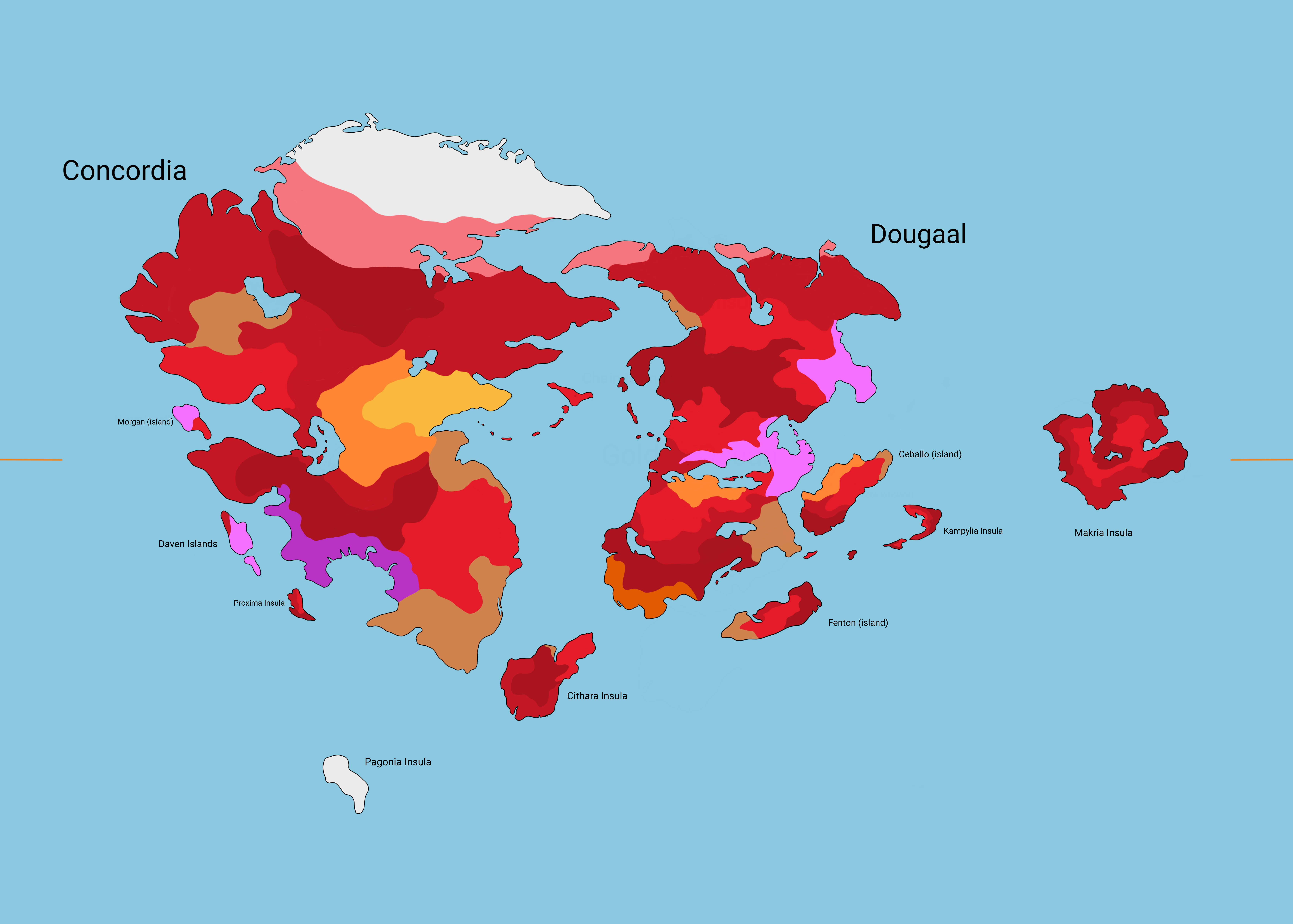
Been able to work on my world map again finally, and have concentrated on just one of the continents.This is just one of the continents from this map [tinyurl.com/y9cfo9nf] (so things like biomes for the continent can be seen there) and the country borders for this continent are here [sta.sh/0iof5ka29oo] .
Comments would be appreciated.
Related content


Comments: 16

just looked at a lot of topographic maps that had similar features to what i wanted to have, then just started drawing squiggly lines till i had the shapes i wanted, where i wanted them - fill those outlines with the same colour, then repeat with next colour for the next level up.
Just tried to be as random as possible, but still making sure each height contained "echoes" of the level below it where necessary (things like river valleys pointing towards bays and such on the coastline)
👍: 0 ⏩: 2

Do you have a scale for the colours?
👍: 0 ⏩: 1
key is same for all maps, but does not yet include areas below sea level, and of course, i haven't done the Bathymetry yet...
👍: 0 ⏩: 1
Cool. Its interesting to see what people use for a scale... I am about to embark on the mountains of my own world (exploring plates at the moment) and like to see what others are doing. Looking forward to the Bathymetry maps.
👍: 0 ⏩: 0
not really sure what you mean by this?
...but I've put together a rough example of how i do topography in Sta.sh... here... Point1 .
1. draw the coastline.
2. fill the land and sea
3. assuming the "land" is from sea-level up to 100m, select a lighter colour, and draw the boundary of the next height of land...
4. ...and fill. this is, let's say, 100m-200m high. don't forget to have "islands" of land of this height for hills/low mountains near the coast.
5. repeat
6. repeat.
7. repeat on and on, until you have the mountains you want...
.
.
.
12. Bathymetry is exactly the same as topography, just underwater, so just make the ocean darker as you go further out. Add rivers, following the valleys
if that doesn't answer you, feel free to ask (just try to be a touch more specific with your question?)
👍: 0 ⏩: 1

Are there any tutorials for this sort of thing?
👍: 0 ⏩: 1
Not really sure... i just tended to wing it with my stuff - more and more practice makes it easier both to do it, and see how things should work.
Look at topographic maps - really look at them, and you'll pick up on how landforms work.
I'd be willing to bet that there are tutorials around on DA but i don't really know *where*. Maybe over in Cartography Guild.
Found one (sort of) posted by user vorropohaiah
best of luck with things...
👍: 0 ⏩: 0
File now updated to address obvious "Sicily" and "Tunisia" on map  (Smile)")
Lengthening the Sicily island a little also gave me the opportunity to do a little sociopolitical world-building as well... as you'll see from the borders (in Sta.sh) the 45° border that starts on the mainland, also runs through the northern end of the island. This was due to a missed detail in a peace treaty between the two nations involved.
👍: 0 ⏩: 0

LOL
That is actually one (including the nearby coastline to the south) of only two pieces of the map that are *directly* copied from reality.
(and now that it's been pointed out, i realise it is a tad obvious, so i might change it a bit)
👍: 0 ⏩: 1

Yeah, i see Tunisia and Sicily x)
Otherwise you really did a great job. The continent has a nice original shape no details are over the top nor boring. This is a right balance, bravo sir.
I just wonder if rivers shouldn't take their source more inside this big massive in the middle. Maybe you have reason to not do so though.
👍: 0 ⏩: 1
thanks for your comment Tonio103, appreciated. Now hopefully i can continue to do the same (no details over the top or boring) with the other 4 continents
...and there are a lot more rivers with their source inside the central mountains. They may be equatorial, but they are still snow-capped due to their height, and most certainly do produce a lot of melt water. ...i just didn't want to crowd out the continental map with too many rivers.
")
👍: 0 ⏩: 1
This is a hard balance to achieve, i dream to come up one day with the map of a planet that would be as interesting as Earth, as varied and not be a simple copy of it.
Oh ok. I just thought that some of the already existing rivers seemed to have missed opportunities to flow from the big massive, though I agree with you that you shouldn't add any rivers.
I did a little experiment as an exemple :
👍: 0 ⏩: 1
no, no, i like
👍: 0 ⏩: 0