HOME | DD
 DWebArt — AltUnitedStatesCivilWarMap

Published: 2011-03-05 00:12:05 +0000 UTC; Views: 3302; Favourites: 28; Downloads: 118
Redirect to original
Description
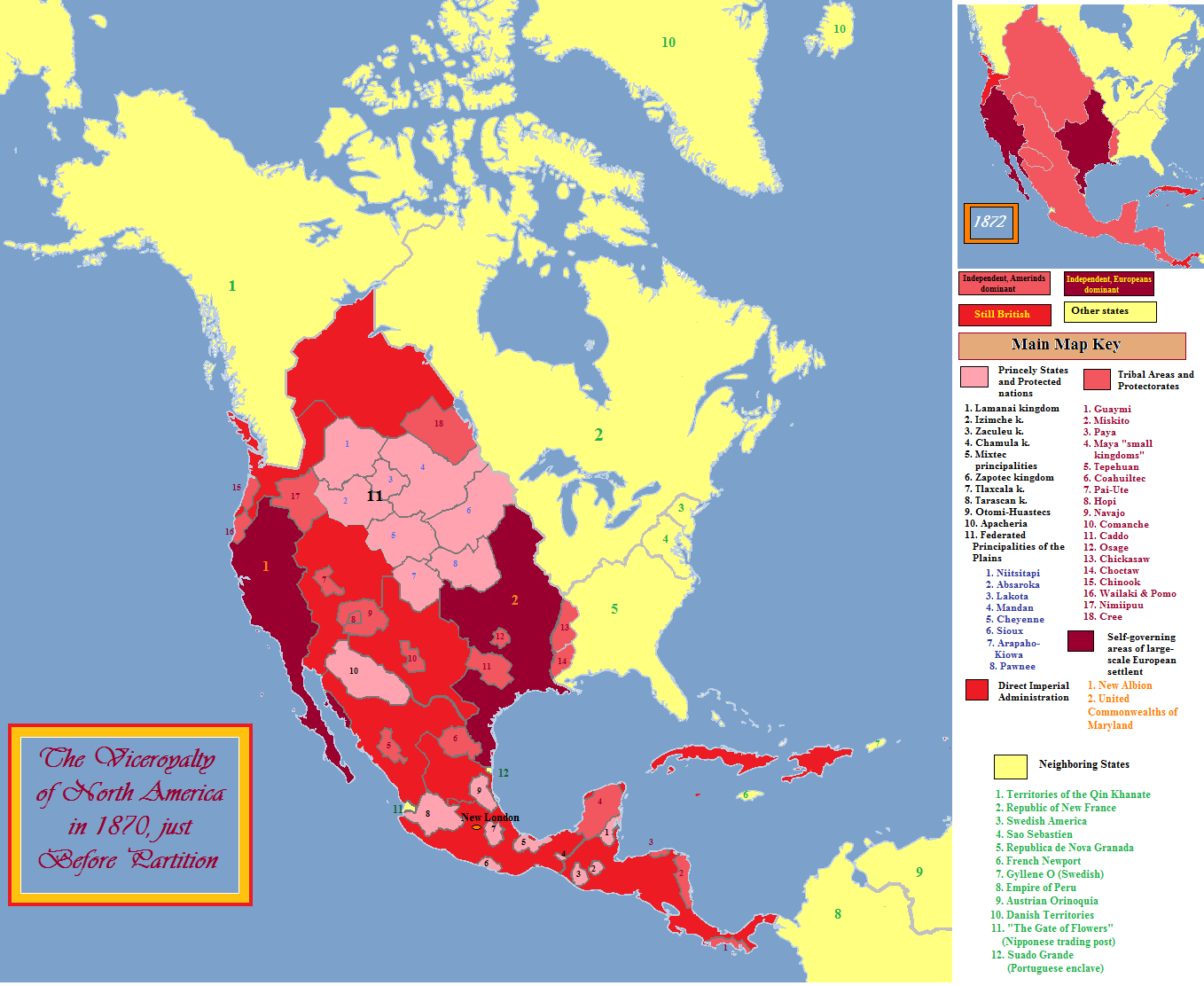
Set in the same alternate universe as my AltUnitedStatesMap.This map is much simpler and lacks much info.
It was pretty much just a little side thing I did.
Related content


Comments: 11

I found it funny how people in the comments kept thinking that this WASN'T a ACW map. Anyway, I agree with frenchfriar that either Transylvania would have seceded as well, or both it and Franklin would have remained with the Union. I would also like to point out that at this time, your state of "Nevada" remained very sparsely populated, with most of its POD population settling in "Nataqua". It would most likely still be a territory at this point in time. In fact, the borders of "Nataqua" are very similar to the OTL borders of Nevada at the start of the American Civil War.
👍: 0 ⏩: 0

Why are Kansas and California different? Kansas was admitted to the Union in 1861 and California in 1850.
👍: 0 ⏩: 2
The map's POD is well before the American Civil War.
👍: 0 ⏩: 0

I dont understand your question.
👍: 0 ⏩: 0

hm, actually, considering the politics of our time line during the Civil War in those areas, you might wish to swap allegiances for Franklin and Transylvania. Otherwise, I quite like this.
👍: 0 ⏩: 0

 (Smile)")
Why would I put 'Civil War' in my title if the Civil War didnt happen?
This map shows the divisions of the states during the war.
👍: 0 ⏩: 1

Ah, that's true! My mistake.

👍: 0 ⏩: 0