HOME | DD
 DWebArt — AltUnitedStatesMap

Published: 2011-03-05 00:10:04 +0000 UTC; Views: 3823; Favourites: 49; Downloads: 259
Redirect to original
Description
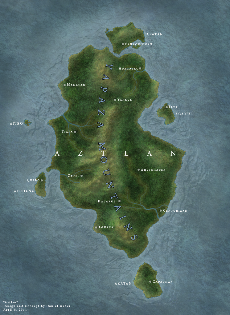
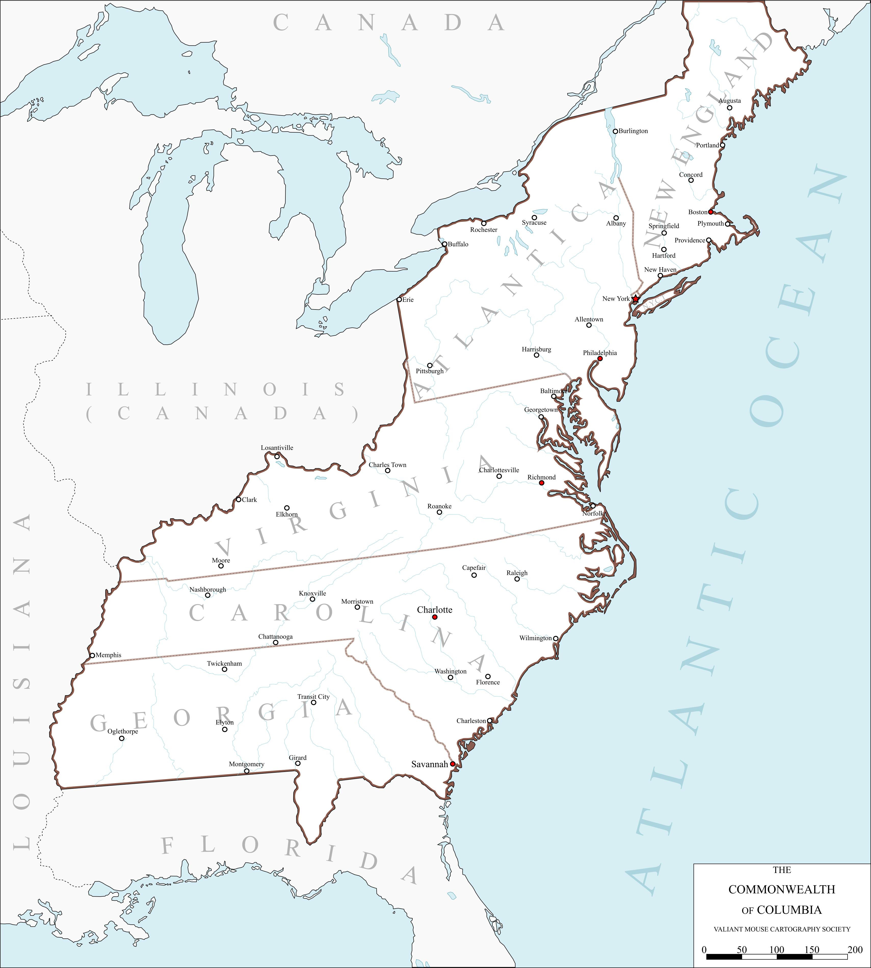
An alternate map of the United States based upon propositions for states that might have existed.Map includes flags of all the states, as well as their abbreviations and capitals.
Related content


Comments: 27


I always found it odd that the proposed state of Wyoming didn't actually contain the Valley of Wyoming in northeastern Pennsylvania.
👍: 0 ⏩: 0

aaaaaaaaaaaaaaaaaaaaaaaaaaaaaaaaaaaaayyyyyyyyyyyyyyyyyyyyyyyyyyyyy
👍: 0 ⏩: 1
mmmmmmmmuuuuuuuyyyyyyy buenooo
👍: 0 ⏩: 1


D: No New Mexico.
Welp, better than not having the region at all.
👍: 0 ⏩: 1

Yeah, this map was based on ideas for states that, for whatever reason, never came to be, some of which were in the same area as New Mexico.
👍: 0 ⏩: 1

I recant my comment as I just noticed crisandm's addressed the same thing.
👍: 0 ⏩: 0

Nicely done, especially in the additions of the state capitols, flags, and abbreviations. I greatly respect your being able to keep to two letter abbreviations, that gets intensely more difficult the more states you add. I like your choice of colors, and you have interesting borders for your states.
My only criticism would be that the southern border of your Tennessee does not follow a line of latitude, but I can accept that if there is some reason for its apparent northward center curve (relative to latitude, of course).
I love many of your new states, but I admire Bering especially, and the shape you gave to West Florida.
Very cool.
👍: 0 ⏩: 1
Some of the lines are a little off.
Between my source map, a geographic map i used to try and get rivers down, and the various maps i found showing approximations where these fake states would be, some lines are not as perfect as I would like.
I make these maps as practice, so Im still getting the hang of some stuff
👍: 0 ⏩: 1
I think you have done an amazing job. Trust me, I understand what a nightmare placing vague borders can be, or trying to follow a natural border that seems to be shown differently on every map, or adjusting a line shown in one map projection for a different projection. You have done altogether well on this one.
👍: 0 ⏩: 0

If youre interested in seeing them bigger I uploaded a chart of the maps
👍: 0 ⏩: 0

 (Wink)")
Of course.
Spain did hand over Cuba to the US after all. If Roosevelt hadnt abandoned that part of the treaty and allowed Cuba to have its freedom, it very well could have remained a territory of the US or even became a state.
👍: 0 ⏩: 1

It could be interesting, for alternative reality purposes...

👍: 0 ⏩: 0

Did you by chance by a book in which many of these where featured, i ask only because i have recently bought this book and was planning on doing a map like this.
👍: 0 ⏩: 1
I am unsure of which book you speak of, but I was inspired by two books.
How The States Got Their Shapes
&
Lost States
👍: 0 ⏩: 1
Its an interesting read.
I kinda wish it went into even more detail tho.
👍: 0 ⏩: 1
Yeah, but hey its a pretty cool book either way.
👍: 0 ⏩: 0