HOME | DD
 Naeddyr — Avoiding polar distortion
by-nc-sa
Naeddyr — Avoiding polar distortion
by-nc-sa

Published: 2009-04-13 19:22:40 +0000 UTC; Views: 4884; Favourites: 28; Downloads: 108
Redirect to original
Description
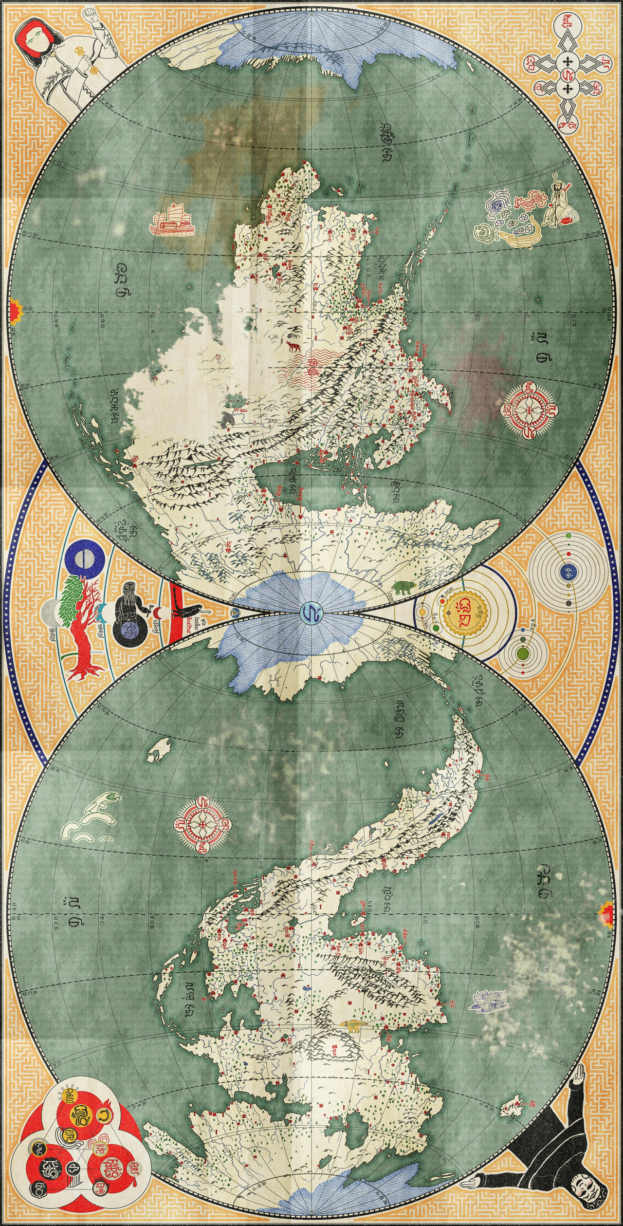
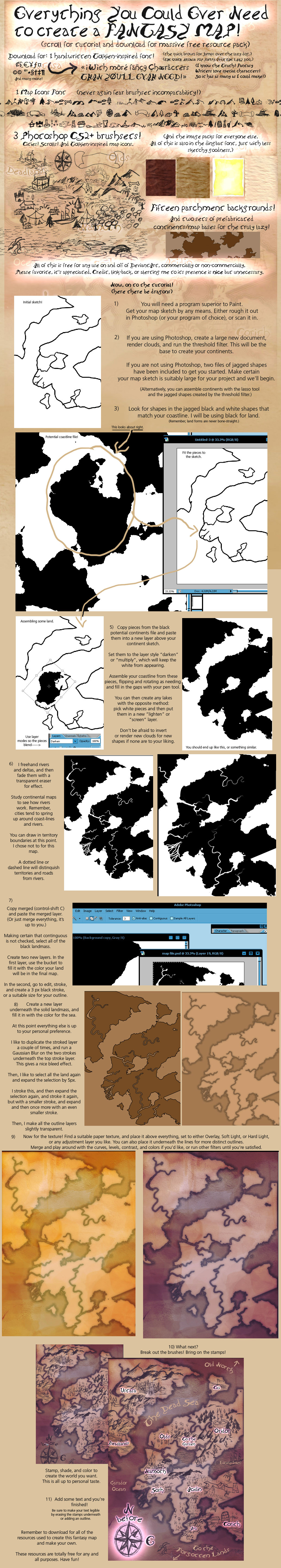
A tutorial for all of you who want a simple way to be able to draw poles for your maps. Uses equirectangular maps for base, which is pretty standard in computerised cartography.Related content


Comments: 9


 (Smile)")

Are you even going to use it? ")
Side-note, recently I've been totally into designing almost-familiar-but-not-quite animal species, and megafauna have been close to my heart. <3
👍: 0 ⏩: 1

Oh cool!
Yes, I have a map, but I Goolgled one of the Map-Making Programs that you used a while ago, and, well... It wouldn't work somehow though. I was really dissappointed. But! I might try again soon though, to see if I can find out what i did wrong there.
👍: 0 ⏩: 1
Do you mean G-projector? Yeah, the current version is hella buggy. You might have to wait for a new one, or get the old one from here [link]
👍: 0 ⏩: 1
Thanks!
Oh.
Erm.
It tries to load... And... Then it comes up with an Error Message, Though!
Do you use it on Vista?
")
👍: 0 ⏩: 1
Yes, I used it on Vista. It also works on XP.
Oh yes, you need Java runtime installed, which you can download here: [link]
👍: 0 ⏩: 1
It still won't work. But. I think that I might have to Restart Windows too though, and, well, I can't do that right now though. 
So.
I shall try that later though.
👍: 0 ⏩: 0